Carson National Forest
| Carson National Forest | |
|---|---|
|
IUCN category VI (protected area with sustainable use of natural resources)
|
|

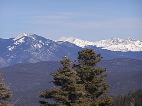
Sangre de Cristo Mountains in Carson National Forest
|
|
| Location | New Mexico, United States |
| Nearest city | Taos, NM |
| Coordinates | 36°31′02″N 106°04′01″W / 36.517222°N 106.066944°WCoordinates: 36°31′02″N 106°04′01″W / 36.517222°N 106.066944°W |
| Area | 1,391,674 acres (5,631.90 km2) |
| Established | July 1, 1908 |
| Governing body | U.S. Forest Service |
| Website | Carson National Forest |
Carson National Forest is a national forest in northern New Mexico, United States. It encompasses 6,070 square kilometers (1.5 million acres) and is administered by the United States Forest Service. The Forest Service's "mixed use" policy allows for its use for recreation, grazing, and resource extraction.
Wheeler Peak, the highest mountain in New Mexico at 13,161 feet (4,011 m), is located in the National Forest.
The forest is located mainly in Rio Arriba (63.4% of acreage) and Taos (34.65%) counties, but smaller areas extend eastward into western Mora and Colfax counties.
Big game animals roam this forest. They include mule deer, elk, pronghorn, cougars, black bears, and bighorn sheep. There are also many species of smaller mammals and songbirds. Forest personnel work closely with the State Game and Fish Department to provide the best wildlife habitat possible. Carson has four hundred miles of sparkling clean mountain streams and numerous lakes. Many of them are stocked with native trout by the Game and Fish Department.
The forest was once inhabited by the Ancestral Pueblo (Anasazi) people, who left ruins of adobe dwellings and other artifacts at an archaeological site now called Pot Creek Cultural Site. Some areas of the forest were formerly lands granted to settlers by the Spanish monarchy and the Mexican government. After the Mexican-American War, the national forest was established, and was named for American pioneer Kit Carson.
...
Wikipedia

