Carroll County, MD
| Carroll County, Maryland | |||
|---|---|---|---|
| County | |||
| Carroll County | |||
|
|||
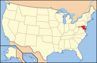
 Location in the U.S. state of Maryland |
|||
 Maryland's location in the U.S. |
|||
| Founded | January 19, 1837 | ||
| Named for | Charles Carroll of Carrollton | ||
| Seat | Westminster | ||
| Largest community | Eldersburg | ||
| Area | |||
| • Total | 453 sq mi (1,173 km2) | ||
| • Land | 448 sq mi (1,160 km2) | ||
| • Water | 5.1 sq mi (13 km2), 1.1% | ||
| Population (est.) | |||
| • (2015) | 167,627 | ||
| • Density | 370/sq mi (143/km²) | ||
| Congressional districts | 1st, 8th | ||
| Time zone | Eastern: UTC-5/-4 | ||
| Website | www |
||
Carroll County is a county located in the U.S. state of Maryland. As of the 2010 census, the population was 167,134. Its county seat is Westminster.
Carroll County is included in the Baltimore-Columbia-Towson, MD Metropolitan Statistical Area, which is also included in the Washington-Baltimore-Arlington, DC-MD-VA-WV-PA Combined Statistical Area. While predominantly rural, the county has become increasingly suburban in recent years.
Carroll County was created in 1837 from parts of Baltimore and Frederick Counties, see Hundred (division). It was named for Charles Carroll of Carrollton (1737–1832), signer of the American Declaration of Independence.
During the American Civil War, the population of Carroll County was sharply divided between supporters of the Union and the Confederacy. In 1863, there were significant troop movements through the county as part of the Gettysburg campaign. On June 29, 1863, the cavalry skirmish known as Corbit's Charge was fought in the streets of Westminster, when two companies of Delaware cavalry attacked a much larger Confederate force under General J.E.B. Stuart.
In 2013 the Carroll County Board of Commissioners voted to make English the official language of the county.
...
Wikipedia


