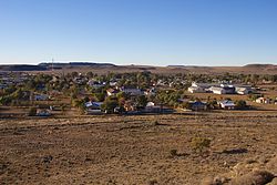
Carnarvon, South Africa
| Carnarvon | |
|---|---|

Carnarvon
|
|
|
|
|
| Coordinates: 30°58′S 22°08′E / 30.967°S 22.133°ECoordinates: 30°58′S 22°08′E / 30.967°S 22.133°E | |
| Country | South Africa |
| Province | Northern Cape |
| District | Pixley ka Seme |
| Municipality | Kareeberg |
| Established | 1853 |
| Area | |
| • Total | 108.75 km2 (41.99 sq mi) |
| Elevation | 1,309 m (4,295 ft) |
| Population (2011) | |
| • Total | 6,612 |
| • Density | 61/km2 (160/sq mi) |
| Racial makeup (2011) | |
| • Black African | 4.8% |
| • Coloured | 86.8% |
| • Indian/Asian | 0.3% |
| • White | 7.6% |
| • Other | 0.5% |
| First languages (2011) | |
| • Afrikaans | 96.2% |
| • English | 1.6% |
| • Other | 2.3% |
| Postal code (street) | 8925 |
| PO box | 8925 |
| Area code | +2753 |
| Website | http://www.carnarvon.co.za/ |
Carnarvon is a small town in the Northern Cape Province of South Africa.
Carnarvon was established in 1853 on a route between Cape Town and Botswana that was followed by early explorers and traders. It was originally established as a Rhenish mission station under the name of Harmsfontein (who previously established Schietfontein to the west), which later developed into a village. It was renamed Carnarvon in honour of the British Colonial Secretary, Lord Carnarvon (1831–1890).
The town is known for its corbelled houses - domed-roof houses constructed from flat stones - which were built between 1811 and 1815.
The Afrikaans poet A.G. Visser had strong associations with Carnarvon, and the house where he lived in the town still stands.
Carnarvon Museum contains exhibits on the region's cultural history. The building was constructed in 1907, and was originally the community hall for the Dutch Reformed Church before being donated to the municipality when a new community centre was constructed in 1973. The museum holds a number of antiques related to the area, including an old hearse previously used by the Dutch Reformed Church. A corbelled house is preserved outside the museum, which was relocated from a nearby farm.
An English-built fort was constructed on top of the hill that overlooks Carnarvon during the Second Boer War. The hill, now named Koeëlkop (after the Afrikaans word for bullet, koeël), is now used for a water reservoir; the remains of the fort were later rebuilt.
Carnarvon is a busy farming centre. Its main agricultural activity is [dorper] sheep farming.
The town centre has a Spar store.
The MeerKAT radio telescope array is under construction at a site around 90 km from Carnarvon. The core of the Square Kilometre Array will also be constructed on the same site.
...
Wikipedia


