Caribou Mountains (Alberta)
| Caribou Mountains | |
|---|---|

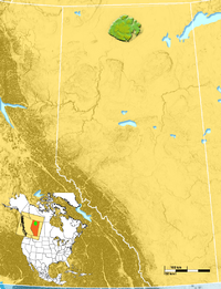
Location of Caribou Mountains in Alberta
|
|
| Highest point | |
| Elevation | 1,030 m (3,380 ft) |
| Prominence | ~700 m (2,297 ft) |
| Coordinates | 59°11′32″N 115°35′33″W / 59.19222°N 115.59250°W |
| Geography | |
| Location | Northern Alberta, Canada |
The Caribou Mountains are a mountain range in northern Alberta, Canada surrounding a saucer-shaped elevated plateau that rises "700 m (2,297 ft) above the surrounding lowlands." The Caribou Mountains reach an elevation of up to 1,030 m (3,379 ft), making them the highest in northern Alberta. They rise north of the lower Peace River, and are bounded to the north and east by the Wood Buffalo National Park. The area was unglaciated during the Last glacial period.
Because of their unique environment, Caribou Mountains Wildland Park 5,910 km2 (2,280 sq mi), was created in 2001 as part of the Special Places program. The largest provincial Wildland Park in the province, its fragile ecosystem contains sensitive wetlands, permafrost habitat and rich bird breeding habitat. "A population of up to 120 wood bison, an endangered species, lives in the Wentzel Lake area in small groups of up to 15 animals."
"The Park contains relatively undisturbed and lichen-rich forests, favoured habitat for woodland caribou. About 80 percent of the range of an important population of woodland caribou is contained within the Park, and about a third of Alberta’s population of this threatened species is dependent on the Park."
Coordinates: 59°11′32″N 115°35′33″W / 59.19222°N 115.59250°W
...
Wikipedia
