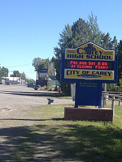
Carey, Idaho
| Carey, Idaho | |
|---|---|
| City | |
 |
|
 Location in Blaine County and the state of Idaho |
|
| Coordinates: 43°18′34″N 113°56′43″W / 43.30944°N 113.94528°WCoordinates: 43°18′34″N 113°56′43″W / 43.30944°N 113.94528°W | |
| Country | United States |
| State | Idaho |
| County | Blaine |
| Area | |
| • Total | 3.31 sq mi (8.57 km2) |
| • Land | 3.31 sq mi (8.57 km2) |
| • Water | 0 sq mi (0 km2) |
| Elevation | 4,783 ft (1,458 m) |
| Population (2010) | |
| • Total | 604 |
| • Estimate (2012) | 594 |
| • Density | 182.5/sq mi (70.5/km2) |
| Time zone | Mountain (MST) (UTC-7) |
| • Summer (DST) | MDT (UTC-6) |
| ZIP code | 83320 |
| Area code(s) | 208 |
| FIPS code | 16-12790 |
| GNIS feature ID | 0396234 |
Carey is a city in Blaine County, Idaho, United States. The population was 604 at the 2010 census. Carey is primarily an agricultural city and is the location of the Blaine County Fairgrounds. Nearby recreational destinations include the Craters of the Moon National Monument, Carey Lake, Silver Creek and the Little Wood River. Further west is the Big Wood River Valley, leading to the Sun Valley resort. In recent years, the city of Carey has experienced significant growth.
Carey is located at 43°18′34″N 113°56′43″W / 43.30944°N 113.94528°W (43.309319, -113.945293), at an elevation of 4783 feet (1458 m) above sea level.
According to the United States Census Bureau, the city has a total area of 3.31 square miles (8.57 km2), all of it land.
Carey is located at the junctions of U.S. Routes 26/93 and 20 and is the commercial center of the Little Wood River Valley. It was founded by a group of Mormon colonists led by Cyrus Joseph Stanford in 1883 who named the town "Marysville." It was renamed "Carey" with the arrival of his younger brother, Thomas C. Stanford in 1884.
...
Wikipedia
