Cape Sorell
| Cape Sorrell | |
|---|---|

False colour Landsat image showing Macquarie Harbour with Cape Sorell in the centre right area of the picture.
|
|
|
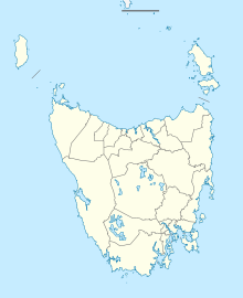
Location in Tasmania
|
|
| Location | West Coast, Tasmania, Australia |
| Coordinates | 42°11′24″S 145°09′36″E / 42.19000°S 145.16000°ECoordinates: 42°11′24″S 145°09′36″E / 42.19000°S 145.16000°E |
Cape Sorell is a headland located in the Southern Ocean outside Macquarie Harbour on the West Coast of Tasmania, Australia. The cape and the Cape Sorell Lighthouse, located above the headland, are important orientation points for all vessels entering the Macquarie Heads and then through Hells Gates at the entrance to the harbour.
Cape Sorrell is named in honour of William Sorell, Lieutenant-Governor of Tasmania from 1817 to 1824.
The Cape Sorell Waverider Buoy, also known as Captain Fathom as named by the listeners of ABC Radio, Tasmania during the May 2015 to mark the centenary of the Bureau of Meteorology, is a swell-measuring buoy located west of Cape Sorell some 10 kilometres (6.2 mi) west of Ocean Beach (42°12′S 145°03′E / 42.200°S 145.050°E). It is unique in that it is one of the few wave-riding swell measuring buoys close to land in the region within the Roaring Forties of the Southern Ocean apart from those in New Zealand.
...
Wikipedia

