Cape Leeuwin
|
Cape Leeuwin Western Australia |
|
|---|---|

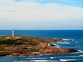
Cape Leeuwin and the Cape Leeuwin Lighthouse as seen from the north
|
|
| Coordinates | 34°22′27″S 115°08′09″E / 34.37417°S 115.13583°ECoordinates: 34°22′27″S 115°08′09″E / 34.37417°S 115.13583°E |
Cape Leeuwin ![]() i/ˈluːwɪn/ is the most south-westerly mainland point of the Australian Continent, in the state of Western Australia.
i/ˈluːwɪn/ is the most south-westerly mainland point of the Australian Continent, in the state of Western Australia.
A few small islands and rocks, the St Alouarn Islands, extend further to the south. The nearest settlement, north of the cape, is Augusta. South-east of Cape Leeuwin, the coast of Western Australia goes much further south. Located on headland of the cape is the Cape Leeuwin Lighthouse and the buildings that were used by the lighthouse keepers.
In Australia, the Cape is considered the point where the Indian Ocean meets the Southern Ocean; however most other nations and bodies consider the Southern Ocean to only exist south of 60°S.
Cape Leeuwin is often grouped with the next headland north, Cape Naturaliste, to identify the geography and ecology of the region. One example is in the name Leeuwin-Naturaliste National Park. Another is in the use of the phrases Cape to Cape or the Capes in tourist promotional materials. A shore base and a ship of the Royal Australian Navy have been named HMAS Leeuwin after the cape.
...
Wikipedia

