Canton St. Gallen
| Kanton St. Gallen | ||
|---|---|---|
| Canton of Switzerland | ||
|
||
 Location in Switzerland |
||
| Coordinates: 47°20′N 9°10′E / 47.333°N 9.167°ECoordinates: 47°20′N 9°10′E / 47.333°N 9.167°E | ||
| Capital | St. Gallen | |
| Subdivisions | 85 municipalities, 8 districts | |
| Government | ||
| • Executive | Regierung (7) | |
| • Legislative | Kantonsrat (180) | |
| Area | ||
| • Total | 2,025.54 km2 (782.07 sq mi) | |
| Population (12/2015) | ||
| • Total | 499,065 | |
| • Density | 250/km2 (640/sq mi) | |
| ISO 3166 code | CH-SG | |
| Highest point | 3,248 m (10,656 ft): Ringelspitz | |
| Lowest point | 396 m (1,299 ft): Lake Constance | |
| Joined | 1803 | |
| Languages | German | |
| Website | SG.ch | |
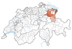
The canton of St. Gallen (German: Kanton St. Gallen ![]() Sankt Gallen ; dialectally /saŋkˈalːə/, French: Canton de Saint-Gall, Italian: Canton San Gallo, Romansh: Chantun Son Gagl) is a canton of Switzerland. The capital is St. Gallen.
Sankt Gallen ; dialectally /saŋkˈalːə/, French: Canton de Saint-Gall, Italian: Canton San Gallo, Romansh: Chantun Son Gagl) is a canton of Switzerland. The capital is St. Gallen.
Located in Northeastern Switzerland, the canton has an area of 2,026 km² (5% of Switzerland) and a resident population close to half a million as of 2015 (6% of Switzerland). It was formed in 1803 as a conflation of the city of St. Gallen, the territories of the Abbey of St. Gall and various former subject territories of the Old Swiss Confederacy.
The canton of St. Gallen is an artificial construct of various historical territories, defined by Napoleon Bonaparte in the Act of Mediation in 1803. About half of the canton's area corresponds to the acquisitions of the abbey of St. Gallen over centuries.
...
Wikipedia


