Candelaria, Quezon
| Candelaria, Quezon | |||||||
|---|---|---|---|---|---|---|---|
| Municipality | |||||||
| Municipality of Candelaria Bayan ng Candelaria |
|||||||
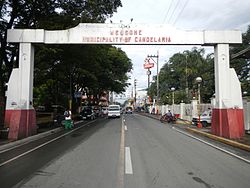
Candelaria Town Proper Welcome Arch, San Pedro Bautista Parish Church, Candelaria Municipal Building, Candelaria Central Business District, Street in Candelaria
|
|||||||
|
|||||||
| Nickname(s): Industrial Town of Quezon Desiccated Coconut Capital |
|||||||
 Map of Quezon showing the location of Candelaria |
|||||||
| Location within the Philippines | |||||||
| Coordinates: 13°55′52″N 121°25′24″E / 13.93111°N 121.42333°ECoordinates: 13°55′52″N 121°25′24″E / 13.93111°N 121.42333°E | |||||||
| Country | Philippines | ||||||
| Region | CALABARZON (Region IV-A) | ||||||
| Province | Quezon | ||||||
| District | 2nd district of Quezon | ||||||
| Founded | August 5, 1879 | ||||||
| Barangays | 25 | ||||||
| Government | |||||||
| • Mayor | Macario Boongaling | ||||||
| • Vice Mayor | George Suayan | ||||||
| Area | |||||||
| • Total | 129.10 km2 (49.85 sq mi) | ||||||
| Population (2015) | |||||||
| • Total | 117,434 | ||||||
| • Rank | 3rd out of 41 in Quezon | ||||||
| • Density | 910/km2 (2,400/sq mi) | ||||||
| Demonym(s) | Candelariahin | ||||||
| Time zone | PST (UTC+8) | ||||||
| ZIP code | 4323 | ||||||
| Dialing code | 42 | ||||||
| Income class | 1st class; partially urban | ||||||
| Website | www |
||||||
Candelaria, officially as the Municipality of Candelaria (Filipino: Bayan ng Candelaria) is a first class municipality in the province of Quezon, Philippines. According to the 2015 census, it has a population of 117,434 people. making the third most populous in the province of Quezon
Candelaria is the second largest industrial center of the province, after Lucena City. Among the municipalities in Quezon Province, Candelaria has the most desiccated coconut factories and oil refineries, such as Peter Paul Philippine Corporation, Primex Coco Products Inc., Pacific Royal Basic Foods, SuperStar Corporation, Tongsan Industrial Development Corporation, and others, which employ thousands of people.
Prior to 1885, the pioneering barangays of Candelaria in its Western part notably, Taguan, Kinatihan and Masin were parts of the Municipality of Tiaong, while Malabanban, Mangilag and Sta. Catalina in the East, were under the jurisdiction of the town of Sariaya.
It was on December 26, 1878, that a permit was granted by the Governor General of the Philippine Islands for the establishment of an independent government over these barangays. Its boundaries were fixed by means of a treaty signed by the notable leaders of Tiaong, Sariaya and the founding families of Candelaria.
The King of Spain, His Majesty Alfonso XII, finally approved the establishment of Candelaria as an independent town on August 5, 1879.
In 1902, after the cessation of the general hostilities against the Americans, administration of Candelaria was merged with the neighboring town of Sariaya. In 1908, after less than seven years, Candelaria was again managed independently, as a fourth-class municipality. During the American regime, the town progressed by leaps and bounds. Many houses and public edifices were constructed, and commerce and industries grew, until the Japanese invasion brought a further wave of destruction.
The municipality lies at the western arm of Quezon Province, about 107 kilometers from Manila and 23 kilometers from Lucena City. At its northern part lies the famous Mount Banahaw, on the east is the town of Sariaya, on the south is San Juan, Batangas, and on the west are Dolores and Tiaong. The neighboring cities are Lucena, Tayabas, San Pablo and Lipa City. It is traversed by the Pan Philippine Highway and the Philippine National Railways.
...
Wikipedia


