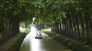
Canal du Midi
| Canal du Midi | |
|---|---|

|
|
| Specifications | |
| Length | 241 km (150 mi) |
| Maximum boat length | 30 m (98 ft) |
| Maximum boat beam | 5.5 m (18 ft) |
| Locks | 65 (originally 86) |
| Maximum height above sea level | 189 m (620 ft) |
| Minimum height above sea level | 0 m (0 ft) |
| Navigation authority | VNF |
| History | |
| Former names | Canal royal en Languedoc |
| Current owner | State of France |
| Original owner | Pierre-Paul Riquet |
| Principal engineer | Pierre-Paul Riquet |
| Other engineer(s) | Marshal Sebastien Vauban, Louis Nicolas de Clerville, François Andréossy |
| Date approved | 1666 |
| Construction began | 1667 |
| Date of first use | 20 May 1681 |
| Date completed | 15 May 1681 |
| Geography | |
| Start point | Toulouse |
| End point | Étang de Thau |
| Beginning coordinates | 43°36′40″N 1°25′06″E / 43.61102°N 1.41844°E |
| Ending coordinates | 43°20′24″N 3°32′23″E / 43.34003°N 3.53978°E Les Onglous lighthouse |
| Branch of | Canal des Deux Mers |
| Connects to | Garonne Lateral Canal, La Nouvelle branch, Canal de Brienne, Hérault River,and Étang de Thau |
| Summit: | Seuil de Naurouze |
| Canal du Midi | |
|---|---|
| Name as inscribed on the World Heritage List | |
 |
|
| Location | France |
| Type | Cultural |
| Criteria | i, ii, iv, vi |
| Reference | 770 |
| UNESCO region | Europe and North America |
| Inscription history | |
| Inscription | 1996 (20th Session) |
| Canal du Midi | |||||||||||||||||||||||||||||||||||||||||||||||||||||||||||||||||||||||||||||||||||||||||||||||||||||||||||||||||||||||||||||||||||||||||||||||||||||||||||||||||||||||||||||||||||||||||||||||
|---|---|---|---|---|---|---|---|---|---|---|---|---|---|---|---|---|---|---|---|---|---|---|---|---|---|---|---|---|---|---|---|---|---|---|---|---|---|---|---|---|---|---|---|---|---|---|---|---|---|---|---|---|---|---|---|---|---|---|---|---|---|---|---|---|---|---|---|---|---|---|---|---|---|---|---|---|---|---|---|---|---|---|---|---|---|---|---|---|---|---|---|---|---|---|---|---|---|---|---|---|---|---|---|---|---|---|---|---|---|---|---|---|---|---|---|---|---|---|---|---|---|---|---|---|---|---|---|---|---|---|---|---|---|---|---|---|---|---|---|---|---|---|---|---|---|---|---|---|---|---|---|---|---|---|---|---|---|---|---|---|---|---|---|---|---|---|---|---|---|---|---|---|---|---|---|---|---|---|---|---|---|---|---|---|---|---|---|---|---|---|---|
| |||||||||||||||||||||||||||||||||||||||||||||||||||||||||||||||||||||||||||||||||||||||||||||||||||||||||||||||||||||||||||||||||||||||||||||||||||||||||||||||||||||||||||||||||||||||||||||||
