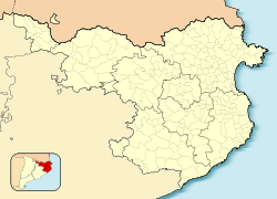
Camprodon
| Camprodon | ||
|---|---|---|
| Municipality | ||
 |
||
|
||
| Location in Catalonia | ||
| Coordinates: 42°18′57″N 2°22′00″E / 42.31583°N 2.36667°ECoordinates: 42°18′57″N 2°22′00″E / 42.31583°N 2.36667°E | ||
| Country |
|
|
| Community |
|
|
| Province | Girona | |
| Comarca | Ripollès | |
| Government | ||
| • Mayor | Francesc Xavier Sala Pujol (2015) | |
| Area | ||
| • Total | 103.4 km2 (39.9 sq mi) | |
| Elevation | 988 m (3,241 ft) | |
| Population (2014) | ||
| • Total | 2,359 | |
| • Density | 23/km2 (59/sq mi) | |
| Demonym(s) | Camprodonins, camprodonines | |
| Website | www |
|
Camprodon (Catalan pronunciation: [kəmpɾuˈðon], locally: [ˌkamburˈðon]; from Camp Rodó "Round Field", ultimately from Latin Campus Rotundus) is a small town in the comarca of Ripollès in Girona, Catalonia, Spain, located in the Pyrenees, near the French border.
The settlement of Camprodon was in 1118, when Ramon Berenguer III allowed the building of a market near the monastery of Sant Pere de Camprodon, which is located in the present-day town. In 1252, Camprodon was granted the title of royal city and left the jurisdiction of the abbot of Sant Pere.
The city celebrates the feast day of Sant Patllari (Palladius of Embrun), and the church of Santa Maria de Camprodon claims his relics, which lie in a 14th-century reliquary (arqueta de Sant Patllari).
The epicentre of the Catalan earthquake of 1428 that killed hundreds of people was near Camprodon. The earthquake was related to the active Amer-Brugent fault system which lies to the south-east of Camprodon.
...
Wikipedia


