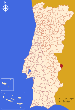
Campo Maior Municipality
| Campo Maior | |||
|---|---|---|---|
| Municipality | |||
|
|||
 |
|||
| Coordinates: 39°00′N 7°03′W / 39.000°N 7.050°WCoordinates: 39°00′N 7°03′W / 39.000°N 7.050°W | |||
| Country |
|
||
| Region | Alentejo | ||
| Subregion | Alto Alentejo | ||
| Intermunic. comm. | Alto Alentejo | ||
| District | Portalegre | ||
| Parishes | 3 | ||
| Government | |||
| • President | João Burrica (PS) | ||
| Area | |||
| • Total | 247.20 km2 (95.44 sq mi) | ||
| Population (2011) | |||
| • Total | 8,456 | ||
| • Density | 34/km2 (89/sq mi) | ||
| Time zone | WET/WEST (UTC+0/+1) | ||
| Website | http://www.cm-campo-maior.pt | ||
Campo Maior (Portuguese pronunciation: [ˈkɐ̃pu mɐˈjɔɾ]), is a municipality in the Portalegre District, Alentejo Region, Portugal. The population in 2011 was 8,456, in an area of 247.20 square kilometres (95.44 sq mi). It is bordered by Spain on the North and East, by Elvas Municipality on the Southeast, and by Arronches Municipality on the West.
Administratively, the municipality is divided into 3 civil parishes (freguesias):
The local castle.
Campo Maior was certainly a Roman settling - the ancient Muro Dam is close by - which was under control of the Moors for half a millennium. In 1219, it was conquered by Christian knights, the Pérez de Badajoz family, who then granted the village, which belonged to the municipality of Badajoz, to the Church of Santa Maria do Castelo (Saint Mary of the Castle).
On May 31, 1255, King Alfonso X of Castile promoted the village to town status.
In 1260, Bishop Friar Pedro Pérez, the Town Lord, granted the first charter (foral) to the inhabitants of Campo Maior. He also introduced the town's first coat-of-arms, showing Our Lady and a lamb, with a legend "Sigillum Capituli Pacensis".
On May 31, 1297, the Treaty of Alcanizes was signed by King Ferdinand IV of Castile and King Denis of Portugal, whereby Campo Maior, together with Olivença and Ouguela, was transferred to the Kingdom of Portugal.
...
Wikipedia


