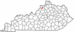
Campbellsburg, Kentucky
| Campbellsburg, Kentucky | |
|---|---|
| City | |
 Location of Campbellsburg, Kentucky |
|
| Coordinates: 38°31′23″N 85°12′16″W / 38.52306°N 85.20444°WCoordinates: 38°31′23″N 85°12′16″W / 38.52306°N 85.20444°W | |
| Country | United States |
| State | Kentucky |
| County | Henry |
| Government | |
| • Mayor | Shelley A. Williams-Noe |
| Area | |
| • Total | 0.6 sq mi (1.5 km2) |
| • Land | 0.6 sq mi (1.5 km2) |
| • Water | 0.0 sq mi (0.0 km2) |
| Elevation | 906 ft (276 m) |
| Population (2010) | |
| • Total | 813 |
| • Estimate (2016) | 791 |
| • Density | 1,246/sq mi (481.2/km2) |
| Time zone | Eastern (EST) (UTC-5) |
| • Summer (DST) | EDT (UTC-4) |
| ZIP code | 40011 |
| Area code(s) | 502 |
| FIPS code | 21-12142 |
| GNIS feature ID | 0488741 |
Campbellsburg is a home rule-class city in Henry County, Kentucky, in the United States. The population was 807 at the 2010 census. It is home to Post 5 of the Kentucky State Police.
The city was incorporated by the state legislature in 1840 as Chiltonsville (in honor of its trustee Charles J. Chilton) but the name was changed within three weeks to Campbellsburg for another local family. Later the same year, the local post office at Benevola was renamed to Campbellsburg as well. The arrival of the Louisville, Cincinnati and Lexington Railroad in 1869 led to a division of the town into Old and New Campbellsburg. The later was separately incorporated in 1876 but eventually expanded until the two polities merged into the present town.
Campbellsburg's central business district was rebuilt after much of it was destroyed by a tornado on April 1, 1974.
Campbellsburg is located at 38°31′23″N 85°12′16″W / 38.52306°N 85.20444°W (38.523111, -85.204391).
According to the United States Census Bureau, the city has a total area of 0.6 square miles (1.6 km2), of which 0.6 square miles (1.6 km2) is land and 1.72% is water.
As of the census of 2000, there were 705 people, 283 households, and 202 families residing in the city. The population density was 1,246.3 people per square mile (477.5/km²). There were 298 housing units at an average density of 526.8 per square mile (201.9/km²). The racial makeup of the city was 94.75% White, 3.83% African American, 0.85% Asian, 0.43% from other races, and 0.14% from two or more races. Hispanic or Latino of any race were 1.28% of the population.
...
Wikipedia
