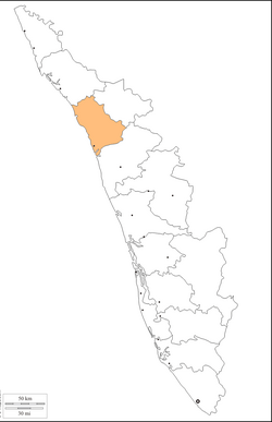
Calicut district
|
Kozhikode district Calicut district |
|
|---|---|
| District | |
 Location in Kerala |
|
| Coordinates: 11°15′N 75°46′E / 11.25°N 75.77°ECoordinates: 11°15′N 75°46′E / 11.25°N 75.77°E | |
| Country |
|
| State | Kerala |
| Headquarters | Kozhikode |
| Government | |
| • Collector | U V Joseph IAS |
| Area | |
| • Total | 2,344 km2 (905 sq mi) |
| Population (2011) | |
| • Total | 3,089,543 |
| • Density | 2,025/km2 (5,240/sq mi) |
| Languages | |
| • Official | Malayalam, English |
| Time zone | IST (UTC+5:30) |
| ISO 3166 code | IN-KL |
| Vehicle registration | Calicut City-KL11, Vatakara-KL-18, Koyilandy-KL-56, Koduvally-KL-57 |
| Website | www |
Kozhikode District or Calicut district is a district of Kerala state, on the southwest coast of India. The city of Kozhikode, also known as Calicut, is the district headquarters. The district is 38.25% urbanised.
Kozhikode district is bordered by the districts of Kannur and Mahé (Pondichery) to the north, Wayanad to the east, and Malappuram to the south. The Arabian Sea lies to the west and Western Ghats stretches towards east. Vavulmala is the highest peak in the district. It lies between latitudes 11° 08'N and 11° 50'N and longitudes 75° 30'E and 76° 8'E.
In 2001 the district was divided into four taluks: Kozhikode, Vatakara, Koyilandy and Thamarassery. By the 2011 census there are 12 block panchayats: Balusseri, Chelannur, Koduvally, Kozhikode, Kunnamangalam, Kunnummal, Melady, Panthalayani, Perambraa, Thodannur, Thuneri, and Vatakara.
Present-day Kozhikode District was among the territories ceded to the British East India Company by Tipu Sultan of Mysore in 1792, at the conclusion of the Third Anglo-Mysore War. The newly acquired British possessions on the Malabar Coast were organized into Malabar District, which included the present-day districts of Kannur, Kozhikode, Malappuram, Palakkad, and Wayanad. Kozhikode served as the administrative headquarters of the district. Malabar District was part of the Madras Presidency, a province of British India.
...
Wikipedia


