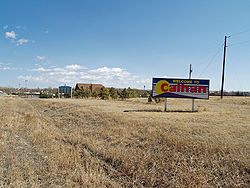
Calhan
| Town of Calhan, Colorado | |
|---|---|
| Statutory Town | |
 |
|
 Location in El Paso County and the state of Colorado |
|
| Coordinates: 39°02′04″N 104°17′57″W / 39.034438°N 104.299139°WCoordinates: 39°02′04″N 104°17′57″W / 39.034438°N 104.299139°W | |
| Country |
|
| State |
|
| County | El Paso County |
| Incorporated | May 10, 1919 |
| Government | |
| • Type | Statutory Town |
| • Mayor (Pro-Term) | Bryan Eurich |
| Area | |
| • Total | 0.8 sq mi (2.2 km2) |
| • Land | 0.8 sq mi (2.2 km2) |
| • Water | 0 sq mi (0 km2) |
| Elevation | 6,535 ft (1,992 m) |
| Population (2010) | |
| • Total | 780 |
| • Density | 920/sq mi (350/km2) |
| Time zone | MST (UTC-7) |
| • Summer (DST) | MDT (UTC-6) |
| ZIP code | 80808 |
| Area code(s) | 719 |
| INCITS place code | 0811260 |
| GNIS feature ID | 0193304 |
The Town of Calhan is a Statutory Town in El Paso County, Colorado, United States. The town population was 780 at the 2010 United States Census. Calhan straddles U.S. Highway 24.
Calhan was established in 1888 as a water station for the now-defunct Chicago, Rock Island and Pacific Railroad, with the first steam locomotive arriving on November 5, 1888. The town was named by and for Michael Calahan, who had the contract to lay railroad tracks from the Colorado/Kansas border to Colorado Springs. However, when the town's first U.S. Post Office opened on November 24, 1888, the middle "a" had been dropped and the town was registered as "Calhan." The town was incorporated as a Statutory Town in 1919.
The town grew quickly, but it wasn't until 1906 that the Calhan Rock Island Railroad Depot was built to meet the growing needs of the area.
Calhan is located at 39°2′7″N 104°17′59″W / 39.03528°N 104.29972°W (39.035395, -104.299835).
According to the United States Census Bureau, the town has a total area of 0.85 square miles (2.2 km2), all of it land.
...
Wikipedia
