Calgary Regional Partnership
| Calgary Region | |
|---|---|
| Metropolitan area | |

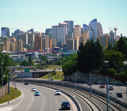
Downtown Calgary skyline
|
|
| Coordinates: 51°N 114°W / 51°N 114°WCoordinates: 51°N 114°W / 51°N 114°W | |
| Country |
|
| Province |
|
| Area (2011) | |
| • CMA | 5,107.55 km2 (1,972.04 sq mi) |
| Population (2011) | |
| • CMA | 1,214,839 |
| • CMA density | 237.9/km2 (616/sq mi) |
| • Total | 1,278,962 |
| Time zone | MST (UTC-7) |
| • Summer (DST) | MDT (UTC-6) |
| Area code(s) | 403, 587, 825 |
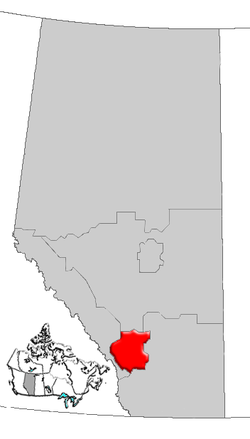
The Calgary Region is an area centred on Calgary, Alberta, Canada. It consists of the City of Calgary, Rocky View County and the municipalities it encloses, and the Municipal (MD) District of Foothills No. 31 and the municipalities it encloses. The Calgary census metropolitan area (CMA) and Calgary Region are different entities. Some municipalities within the region have little or no metropolitan relationship to Calgary in terms of commuting for employment or commerce purposes.
The Calgary Region is a major transportation hub for southern Alberta, Saskatchewan, eastern British Columbia, and parts of the northern United States. It is home to the Calgary International Airport, the third busiest airport in the country in terms of total aircraft movements.
The Calgary CMA, as defined by Statistics Canada, includes the following nine municipalities:
In the 2011 Census, the Calgary CMA had a population of 1,214,839 living in 464,001 of its 488,451 total dwellings, a 12.6% change from its 2006 population of 1,079,310, making it the largest CMA in Alberta and the fifth largest in Canada. With a land area of 5,107.55 km2 (1,972.04 sq mi), it had a population density of 237.9 people per square kilometre in 2011.
Also in terms of area, the Calgary CMA makes up approximately 40% of Statistics Canada's Division No. 6 in Alberta. The balance of Division No. 6 includes the census consolidated subdivisions of the MD of Foothills No. 31 to the south and Mountain View County to the north.
...
Wikipedia

