Cadiz, Kentucky
| Cadiz, Kentucky | |
|---|---|
| City | |

The courthouse in Cadiz burned twice during the American Civil War. This courthouse was demolished in 2008 to make way for a new justice center that opened in October 2009.
|
|
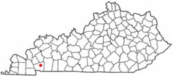
 Location of Cadiz, Kentucky |
|
| Coordinates: 36°52′4″N 87°49′3″W / 36.86778°N 87.81750°WCoordinates: 36°52′4″N 87°49′3″W / 36.86778°N 87.81750°W | |
| Country | United States |
| State | Kentucky |
| County | Trigg |
| Government | |
| • Type | Mayor-council government |
| • Mayor | Todd King |
| Area | |
| • Total | 3.5 sq mi (9.0 km2) |
| • Land | 3.5 sq mi (9.0 km2) |
| • Water | 0.0 sq mi (0.0 km2) |
| Elevation | 423 ft (129 m) |
| Population (2010) | |
| • Total | 2,558 |
| • Density | 685.4/sq mi (264.6/km2) |
| Time zone | Central (CST) (UTC-6) |
| • Summer (DST) | CDT (UTC-5) |
| ZIP code | 42211 |
| Area code(s) | 270 & 364 |
| FIPS code | 21-11692 |
| GNIS feature ID | 0517318 |
| Website | http://cadiz.ky.gov |
Cadiz (local /ˈkeɪdɪz/) is a home rule-class city in and the county seat of Trigg County, Kentucky, United States. The population was 2,373 at the 2000 census. It is part of the Clarksville metropolitan area.
Cadiz is an old town located close to the Land Between the Lakes, a popular recreation area, and was a base of Union and Confederate operations during the Civil War. It permits the sale of alcoholic beverages.
William Henry Perrin's 1884 History of Trigg County does not explain the Spanish name of the town, but does say that in May 1820 the county commission chose Robert Baker's land as its seat. He relinquished his stable yard and the surrounding 50 acres (200,000 m2). From August to October, the commission platted out the town in blocks and gave it the name Cadiz. Rennick's Kentucky Place Names repeats the local tradition that a Spaniard in the surveying party successfully suggested his hometown.
Cadiz is located at 36°52′4″N 87°49′3″W / 36.86778°N 87.81750°W (36.867781, -87.817374).
...
Wikipedia
