Cabugao
| Cabugao | ||
|---|---|---|
| Municipality | ||

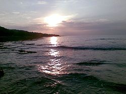
Sunset at Cabugao Beach
|
||
|
||
 Map of Ilocos Sur showing the location of Cabugao |
||
| Location within the Philippines | ||
| Coordinates: 17°48′N 120°27′E / 17.8°N 120.45°ECoordinates: 17°48′N 120°27′E / 17.8°N 120.45°E | ||
| Country | Philippines | |
| Region | Ilocos (Region I) | |
| Province | Ilocos Sur | |
| District | 1st District | |
| Founded | 1781 | |
| Barangays | 33 | |
| Government | ||
| • Mayor | Edgardo "Ediboy" S. Cobangbang Jr. | |
| Area | ||
| • Total | 95.56 km2 (36.90 sq mi) | |
| Population (2015 census) | ||
| • Total | 37,501 | |
| • Density | 390/km2 (1,000/sq mi) | |
| Time zone | PST (UTC+8) | |
| ZIP code | 2732 | |
| IDD : area code | +63 (0)77 | |
| Income class | 1st class | |
| Website | www |
|
Cabugao is a first class municipality in the province of Ilocos Sur, Philippines. According to the 2015 census, it has a population of 37,501 people.
Cabugao is the second northernmost town of the province of Ilocos Sur. It is 27 kilometres (17 mi) from Vigan City, the capital of the province; 55 kilometres (34 mi) from Laoag City (Ilocos Norte); 163 kilometres (101 mi) from the San Fernando, La Union, the regional center; and 432 kilometres (268 mi) north of Manila. It is accessible to almost all modes of land transportation and a 7–kilometer portion of the MacArthur Highway passes through the town center.
Its total land area is 9,556 hectares (23,610 acres). It is bounded on the north by Sinait; on the south by San Juan; on the east by Nueva Era, Ilocos Norte and the Cordillera Mountain Ranges; and on the west by the South China Sea.
The Cordillera mountain range borders on the eastern part of the municipality. Hills are located in all the four corners of the municipality. Off the coast of Barangay Sabang there is Salomague Island.
The Cabugao River is the largest river in the municipality. Two tributaries to the east feed the main channel of the Cabugao River. The headwaters of the north fork of the Cabugao River originate in Sitio Caset in Barangay Maradodon and the southern fork's headwaters originate in Sitio Gaco in Barangay Cacadiran. Cabugao's drinking water supply comes from three water resources in the Cordillera mountain range.
The barangays that lie along the Cabugao River are flood prone areas during the rainy season. The uncontrollable surges of water erode the properties that line the Cabugao River endangering life and limb. The creek that runs through the poblacion easily clogs up in rain causing portions near it to be inundated.
...
Wikipedia


