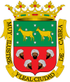
Cabra, Spain
| Cabra | |||
|---|---|---|---|
|
|||
 |
|||
| Coordinates: 37°28′N 4°26′W / 37.467°N 4.433°WCoordinates: 37°28′N 4°26′W / 37.467°N 4.433°W | |||
| Country | Spain | ||
| Comarca | Subbética cordobesa | ||
| Government | |||
| • Mayor | Fernando Priego Chacón ((PP)) | ||
| Area | |||
| • Total | 228.07 km2 (88.06 sq mi) | ||
| Elevation | 452 m (1,483 ft) | ||
| Website | www |
||
Cabra is a rural town in Córdoba province, Andalusia, Spain. It lies along the route between Cordoba and Málaga in the south of Spain. It is an entrance point to the Parque Natural de las Sierras Subbeticas. Although the main activity in Cabra is primary industry, it is noted as a source of red polished limestone. As a settlement, Cabra has existed over centuries, under many different rulers. In 2005, the municipality had a population of 20,940, most of whom (19,523) lived in Cabra township.
Cabra is located in the Province of Córdoba in the autonomous community of Andalusia in southern Spain. The municipality's mean altitude is 452 m (1,483 ft) and it covers 229 km2 (88 sq mi). It has a population density of 91.4 inhabitants per km². The geographical mean coordinates are 37°28′N 4°27′W / 37.467°N 4.450°W, 72 km (45 mi) from the province's capital, Córdoba. The municipality hosts a nature reserve, the Parque Natural de las Sierras Subbéticas. Around Cabra, there are eight smaller villages, including Gaena, Las Huertas Bajas and La Benita. The area is known for its stone, called marmol roja de Cabra. It is not a marble but a pink to red limestone capable of high polish.
in Spanish, the word Cabra means goat.
The city of Cabra has been settled since Paleolithic times. The Turdetani, the Andalusian descendants of Tartessos, lived in the area. As part of the Tartessoian kingdom and during Carthaginian and Roman times, Cabra was a market town.
...
Wikipedia


