Cabadbaran
| Cabadbaran | ||
|---|---|---|
| Component City | ||
| City of Cabadbaran | ||
|
||
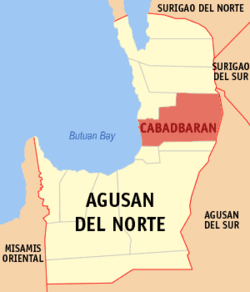
 Map of Agusan del Norte showing the location of Cabadbaran City |
||
| Location within the Philippines | ||
| Coordinates: 9°07′N 125°32′E / 9.12°N 125.53°ECoordinates: 9°07′N 125°32′E / 9.12°N 125.53°E | ||
| Country | Philippines | |
| Region | Caraga (Region XIII) | |
| Province | Agusan del Norte | |
| District | 2nd District of Agusan del Norte | |
| Incorporated | 1894 (town) | |
| Cityhood | 2007 | |
| Barangays | 31 | |
| Government | ||
| • Mayor | Katrina Marie Mortola (Nacionalista) | |
| • Vice Mayor | Rey Jamboy (Liberal) | |
| Area | ||
| • Total | 214.44 km2 (82.80 sq mi) | |
| Population (2015 census) | ||
| • Total | 73,639 | |
| • Density | 340/km2 (890/sq mi) | |
| Time zone | PST (UTC+8) | |
| ZIP code | 8605 | |
| IDD : area code | +63 (0)85 | |
| Income class | 6th city income class | |
| 160203000 | ||
| Electorate | 43,153 voters as of 2016 | |
| Website | www |
|
Cabadbaran (Butuanon: Dakbayan hong Cabadbaran; Cebuano: Dakbayan sa Cabadbaran; Filipino: Lungsod ng Cabadbaran) is the provincial capital city of Agusan del Norte, Mindanao, Philippines. It has a population of 73,639 according to the 2015 census. In the 2016 elections, it had 43,153 voters.
Founded in 1894, the city rose from its Spanish period beginnings to become the premier town of Agusan del Norte. Its rich cultural heritage is evident in its preserved colonial period houses and its archaeological collections.
On August 16, 2000, the seat of provincial government was transferred from Butuan City to Cabadbaran through Republic Act 8811, although the provincial government still holds office in Butuan City, pending the actual transfer of provincial offices to the new capital. Cabadbaran was officially declared a city in 2007.
Cabadbaran lies 9 degrees north latitude and 125 degrees and 30 minutes east longitude in the northeastern part of Mindanao. Its boundaries are Tubay and Santiago to the north, Butuan Bay to the west, Magallanes and R. T. Romualdez to the south, and Sibagat, Agusan del Sur to the east. It is 29 kilometres (18 mi) from Butuan City. It is generally flat with rolling hills and swamplands in its western part. The highest of all mountains in the Caraga Region, Mount Hilong-Hilong (with an altitude of 2,012 metres (6,601 ft) above sea level), rises in this city.
...
Wikipedia


