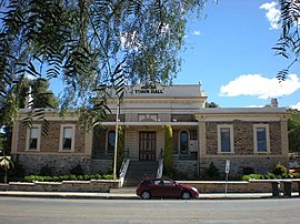
Burra, South Australia
|
Burra South Australia |
|||||||||||||
|---|---|---|---|---|---|---|---|---|---|---|---|---|---|

Burra Town Hall
|
|||||||||||||
| Coordinates | 33°40′0″S 138°56′0″E / 33.66667°S 138.93333°ECoordinates: 33°40′0″S 138°56′0″E / 33.66667°S 138.93333°E | ||||||||||||
| Population | 978 (2006 census) | ||||||||||||
| Established | 1845 | ||||||||||||
| Postcode(s) | 5417 | ||||||||||||
| Elevation | 474 m (1,555 ft) | ||||||||||||
| Location |
|
||||||||||||
| LGA(s) | Regional Council of Goyder | ||||||||||||
| State electorate(s) | Stuart | ||||||||||||
| Federal Division(s) | Grey | ||||||||||||
|
|||||||||||||
Burra is a pastoral centre and historic tourist town in the mid-north of South Australia. It lies east of the Clare Valley in the Bald Hills range, part of the northern Mount Lofty Ranges, and on Burra Creek. The town began as a single company mining township that, by 1851, was a set of townships (company, private and government-owned) collectively known as "The Burra". The Burra mines supplied 89% of South Australia's and 5% of the world's copper for 15 years, and the settlement has been credited (along with the mines at Kapunda) with saving the economy of the struggling new colony of South Australia. The Burra Burra Copper Mine was established in 1848 mining the copper deposit discovered in 1845. Miners and townspeople migrated to Burra primarily from Cornwall, Wales, Scotland and Germany. The mine first closed in 1877, briefly opened again early in the 20th century and for a last time from 1970 to 1981.
When the mine was exhausted and closed the population shrank dramatically and the townships, for the next 100 years, supported pastoral and agricultural activities. Today the town continues as a centre for its surrounding farming communities and, being one of the best-preserved towns of the Victorian era in Australia, as a historic tourist centre.
The Burra Charter, which outlines the best practice standard for cultural heritage management in Australia, is named for a conference held here in 1979 by Australia ICOMOS (International Council on Monuments and Sites) where the document was adopted.
Burra is located within the Hundred of Kooringa a few kilometres inside Goyder's Line, near Burra, Baldina and Gum creeks.
The main body of copper ore formed between two geological faults in broken dolomite rocks. The ore body was up to 70 metres (230 ft) wide and mainly consisted of green malachite and blue azurite veins and nodules amongst the host rock. The malachite and azurite were formed from copper sulphide minerals, by a process known as "secondary enrichment". This process took millions of years to convert the low grade copper sulphide ore, which was probably created 300 to 400 millions of years ago during the last period of vulcanism near Burra.
...
Wikipedia

