Burlingame, Kansas
| Burlingame, Kansas | |
|---|---|
| City | |

U.S. post office in Burlingame (2009)
|
|
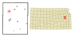
 Location within Osage County and Kansas |
|
 KDOT map of Osage County (legend) |
|
| Coordinates: 38°45′3″N 95°50′9″W / 38.75083°N 95.83583°WCoordinates: 38°45′3″N 95°50′9″W / 38.75083°N 95.83583°W | |
| Country | United States |
| State | Kansas |
| County | Osage |
| Government | |
| • Type | Mayor–Council |
| • Mayor | Ray Hovestadt |
| • City Clerk | Patti Gilbert |
| Area | |
| • Total | 0.89 sq mi (2.31 km2) |
| • Land | 0.89 sq mi (2.31 km2) |
| • Water | 0 sq mi (0 km2) |
| Elevation | 1,073 ft (327 m) |
| Population (2010) | |
| • Total | 934 |
| • Estimate (2015) | 892 |
| • Density | 1,000/sq mi (400/km2) |
| Time zone | Central (CST) (UTC-6) |
| • Summer (DST) | CDT (UTC-5) |
| ZIP code | 66413 |
| Area code | 785 |
| FIPS code | 20-09350 |
| GNIS feature ID | 0479434 |
| Website | burlingameks.com |
Burlingame is a city in Osage County, Kansas, United States. As of the 2010 census, the city population was 934.
Burlingame was originally established as Council City and was an important stop on the Santa Fe Trail. The Council City post office was opened on April 30, 1855. The wide brick main street, Santa Fe Avenue, was built wide enough for an oxen team to be able to make a U-turn. The city and post office name was changed from Council City to Burlingame on January 30, 1858, in honor of Anson Burlingame.
During the Civil War the townspeople constructed a stone fort in the town center. Burlingame's Fort was torn down after the war.
Burlingame is located on U.S. Route 56, about 20 miles (32 km) south of Topeka. According to the United States Census Bureau, the city has a total area of 0.89 square miles (2.31 km2), all of it land.
The climate in this area is characterized by hot, humid summers and generally mild to cool winters. According to the Köppen Climate Classification system, Burlingame has a humid subtropical climate, abbreviated "Cfa" on climate maps.
Burlingame is part of the Topeka, Kansas Metropolitan Statistical Area.
As of the census of 2010, there were 934 people, 404 households, and 250 families residing in the city. The population density was 1,049.4 inhabitants per square mile (405.2/km2). There were 501 housing units at an average density of 562.9 per square mile (217.3/km2). The racial makeup of the city was 97.1% White, 0.1% African American, 0.4% Native American, 0.5% from other races, and 1.8% from two or more races. Hispanic or Latino of any race were 1.1% of the population.
...
Wikipedia
