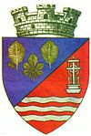
Bunea Mare
| Făget | ||
|---|---|---|
| Town | ||
 |
||
|
||
 Location of Făget |
||
| Coordinates: 45°51′0″N 22°10′48″E / 45.85000°N 22.18000°ECoordinates: 45°51′0″N 22°10′48″E / 45.85000°N 22.18000°E | ||
| Country |
|
|
| County |
|
|
| Status | Town | |
| Government | ||
| • Mayor | Marcel Avram (PNL) | |
| Area | ||
| • Total | 150.87 km2 (58.25 sq mi) | |
| Population (2011) | ||
| • Total | 6,571 | |
| Time zone | EET (UTC+2) | |
| • Summer (DST) | EEST (UTC+3) | |
| Climate | Cfb | |
| Website | http://www.e-primarii.ro/~faget/ | |
Făget (Romanian pronunciation: [fəˈdʒet]) is a town in Timiș County, Banat, western Romania, with a population of about 6,500.
Its name literally means "beech tree forest" in Romanian.
In German: Fatschet; in Hungarian: Facsád; in Serbian: Фагет / Faget.
The town administers ten villages: Bătești (Vadpatak), Begheiu Mic (Bázosd), Bichigi (Kisbékés), Brănești (Avasfalva), Bunea Mare (Bunya), Bunea Mică (depopulated), Colonia Mică (Facsádkistelep), Jupânești (Zsupánfalva), Povârgina (Porzson) and Temerești (Temeres).
In 2002: Romanians (6,604), Hungarians (312), Germans (61), Roma (14), Serbs (2).
The town is situated in the center of a distinct ethno-folkloric area, at the north-west side of the Poiana Ruscă mountains, on the DN68 national road. The road stretches from Ilia to Lugoj—and on the CFR 212 railroad line.
At the north side of Făget, the Bega river is visible. Around it there are still signs of a medieval fortification dating back to 1548 (not fully studied yet).
The town also has on display busts of Eftimie Murgu,Victor Feneșiu and the aviation pioneer Traian Vuia.
...
Wikipedia

