Bundalong, Victoria
|
Bundalong Victoria |
|||||||||||||
|---|---|---|---|---|---|---|---|---|---|---|---|---|---|

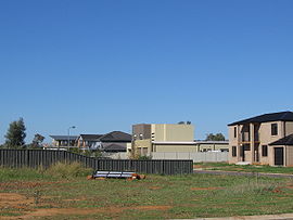
New houses at Bundalong
|
|||||||||||||
| Coordinates | 36°02′S 146°10′E / 36.033°S 146.167°ECoordinates: 36°02′S 146°10′E / 36.033°S 146.167°E | ||||||||||||
| Population | 604 (2011 census) | ||||||||||||
| Postcode(s) | 3730 | ||||||||||||
| Location |
|
||||||||||||
| LGA(s) | Shire of Moira | ||||||||||||
| State electorate(s) | Ovens Valley | ||||||||||||
| Federal Division(s) | Murray | ||||||||||||
|
|||||||||||||
Bundalong is a town in Victoria, Australia located on the Murray River and the Murray Valley Highway, east of Yarrawonga. At the 2011 census, Bundalong had a population of 604. Bundalong is in the Shire of Moira local government area, with the name "Bundalong" being the Aboriginal word for "joined together". The towns farming sites include wheat plantations.
The Bundalong Post office opened on 2 October 1876 and closed in 1940.
...
Wikipedia

