Buhler, Kansas
| Buhler, Kansas | |
|---|---|
| City | |
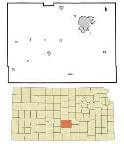
 Location within Reno County and Kansas |
|
 KDOT map of Reno County (legend) |
|
| Coordinates: 38°8′17″N 97°46′22″W / 38.13806°N 97.77278°WCoordinates: 38°8′17″N 97°46′22″W / 38.13806°N 97.77278°W | |
| Country | United States |
| State | Kansas |
| County | Reno |
| Founded | 1888 |
| Government | |
| • Type | Mayor–Council |
| • Mayor | Daniel Friesen |
| • City Clerk | Merrill Peterson |
| Area | |
| • Total | 0.72 sq mi (1.86 km2) |
| • Land | 0.72 sq mi (1.86 km2) |
| • Water | 0 sq mi (0 km2) |
| Elevation | 1,476 ft (450 m) |
| Population (2010) | |
| • Total | 1,327 |
| • Estimate (2015) | 1,332 |
| • Density | 1,800/sq mi (710/km2) |
| Time zone | CST (UTC-6) |
| • Summer (DST) | CDT (UTC-5) |
| ZIP code | 67522 |
| Area code | 620 |
| FIPS code | 20-09200 |
| GNIS ID | 0477731 |
| Website | BuhlerKS |
Buhler is a city in Reno County, Kansas, United States. As of the 2010 census, the city population was 1,327.
The first post office in Buhler was established in 1888.
Buhler was primarily inhabited by Mennonite families that had emigrated from Russia during the 1880s.
In September 2012, the City of Buhler received a letter from the Freedom from Religion Foundation regarding a complaint about perceived constitutual violations about the city seal having a cross in it. In November 2012, the city stated that every legal opinion we received indicated the city has no supportable case in the event the it was sued to legally force us to remove the seal and sign. If the city lost, it would be obligated to pay all the legal fees of the prevailing party. The city decided to hold a contest in January 2013 to redesign the city seal without specific reference to religion.
Buhler is located at 38°8′17″N 97°46′22″W / 38.13806°N 97.77278°W (38.138147, -97.772891). According to the United States Census Bureau, the city has a total area of 0.72 square miles (1.86 km2), all of it land.
As of the census of 2010, there were 1,327 people, 483 households, and 361 families residing in the city. The population density was 1,843.1 inhabitants per square mile (711.6/km2). There were 520 housing units at an average density of 722.2 per square mile (278.8/km2). The racial makeup of the city was 98.1% White, 0.1% African American, 0.7% Native American, 0.1% Pacific Islander, 0.5% from other races, and 0.6% from two or more races. Hispanic or Latino of any race were 2.4% of the population.
...
Wikipedia
