Buchanan County, Missouri
| Buchanan County, Missouri | |
|---|---|

The Buchanan County Courthouse in downtown St. Joseph
|
|
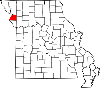
 Location in the U.S. state of Missouri |
|
 Missouri's location in the U.S. |
|
| Founded | December 31, 1838 |
| Named for | James Buchanan |
| Seat | St. Joseph |
| Largest city | St. Joseph |
| Area | |
| • Total | 415 sq mi (1,075 km2) |
| • Land | 408 sq mi (1,057 km2) |
| • Water | 6.6 sq mi (17 km2), 1.6% |
| Population (est.) | |
| • (2015) | 89,100 |
| • Density | 219/sq mi (85/km²) |
| Congressional district | 6th |
| Time zone | Central: UTC-6/-5 |
| Website | www |
| Buchanan County, Missouri | ||||
|---|---|---|---|---|
| Elected countywide officials | ||||
| Assessor | Scot W. Van Meter | Democratic | ||
| Circuit Clerk | Mary Beattie | Democratic | ||
| County Clerk | Mary Baack Garvey | Republican | ||
| Collector | Peggy Campbell | Democratic | ||
|
Commissioner (Presiding) |
Royal “R.T.” Turner | Republican | ||
|
Commissioner (District 1) |
Dan Hausman | Republican | ||
|
Commissioner (District 2) |
Ron Hook | Democratic | ||
| Prosecuting Attorney | Dwight K. Scroggins, Jr. | Democratic | ||
| Public Administrator | Bill McMurray | Democratic | ||
| Recorder | Ed Wildberger | Democratic | ||
| Sheriff | Mike Strong | Democratic | ||
| Treasurer | John D. Nash | Democratic | ||
| Buchanan County, Missouri | ||
|---|---|---|
| 2008 Republican primary in Missouri | ||
| John McCain | 2,194 (31.63%) | |
| Mike Huckabee | 1,825 (26.31%) | |
| Mitt Romney | 2,216 (31.94%) | |
| Ron Paul | 521 (7.51%) | |
| Buchanan County, Missouri | ||
|---|---|---|
| 2008 Democratic primary in Missouri | ||
| Hillary Clinton | 6,689 (57.09%) | |
| Barack Obama | 4,427 (37.78%) | |
| John Edwards (withdrawn) | 413 (3.52%) | |
Buchanan County is a county located in the U.S. state of Missouri. As of the 2010 United States Census, the population was 89,201. Its county seat is St. Joseph. When originally formed in 1838, the county was named Roberts County, after settler Hiram Roberts; it was renamed in 1839 for James Buchanan, then a U.S. Senator and later President of the United States. The county was formed from land annexed to Missouri, as were five other counties.
Buchanan County is included in the St. Joseph, MO-KS Metropolitan Statistical Area.
According to the U.S. Census Bureau, the county has a total area of 415 square miles (1,070 km2), of which 408 square miles (1,060 km2) is land and 6.6 square miles (17 km2) (1.6%) is water.
As of the census of 2000, there were 85,998 people, 33,557 households, and 21,912 families residing in the county. The population density was 210 people per square mile (81/km²). There were 36,574 housing units at an average density of 89 per square mile (34/km²). The racial makeup of the county was 92.73% White, 4.36% Black or African American, 0.42% Native American, 0.45% Asian, 0.02% Pacific Islander, 0.65% from other races, and 1.37% from two or more races. Approximately 2.43% of the population were Hispanic or Latino of any race.
...
Wikipedia
