Bryn, Neath Port Talbot
| Bryn | |
|---|---|
 Bryn |
|
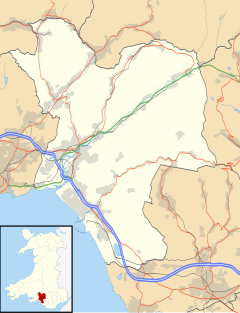
| Bryn shown within Neath Port Talbot | |
| Population | 913 (2001) |
| OS grid reference | SS8192 |
| Community |
|
| Principal area | |
| Ceremonial county | |
| Country | Wales |
| Sovereign state | United Kingdom |
| Post town | PORT TALBOT |
| Postcode district | SA13 |
| Dialling code | 01639 |
| Police | South Wales |
| Fire | Mid and West Wales |
| Ambulance | Welsh |
| EU Parliament | Wales |
| UK Parliament | |
| Welsh Assembly | |
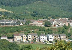
Bryn (English: Hill) is a village and community in Neath Port Talbot County Borough in Wales. It has a population of 913. The village is located in the hills between Cwmafan, in the Afan Valley, and Maesteg in the Llynfi Valley, approximately 6 miles (9.7 km) from Port Talbot and 2 miles (3.2 km) from Maesteg. The name of the village now familiarly 'Bryn', is Bryntroedygam. So wrote the first vicar of St Theodore's in Port Talbot. There was a farm situated above Meadow Row named Bryn-Troed-y-Garn as shown on the 1876 OS map, as many more immigrants came to 'Bryntroedygam' it seemed the name of the village was to be shorted to Bryn. 12% of the village (112 out of 913 people) speak Welsh.
Its clear from the OS maps from the last century that Bryn was honeycombed with coal resources. Some of these could be in the form of outcrops which could be hand picked from the surface, its likely that farmers would pick these for domestic, although such pickings belonged to the landlord and not the farmer tenant.
Deeds relating to Margam Abbey indicated that the monks were exploiting coal measures in or near Bryn about the year 1250, although coal mining in Bryn did not operate on any scale until the 18th century. It is believed that the copper miner at Cwmavon extended their operations to Bryn soon after 1841, at the time when this kind of coal for copper smelting was becoming more scarce in the Afan valley. The location is not certain, although the first Vicar of St Theodore's Church 'D J Jones' refers to the site as Drysiog Farm. In order to move this vast amount of coal to the copper works, a mineral railway was constructed. The bed of the railway can still be traced by turning at the Carmel church and following the line adjacent to Bryngurnos Street and along the B4282 towards Cwmavon.
The production of coal in the village caused a huge expansion in housing with a population in the 1841 census of 111 to a population of 558 in 1851. To provide for the huge increase the collieries a rapid housing programme began with 15 dwellings in 1841 to 96 in 1851. The familiar street names Bryn farm cottages, Buck Row, Yard Row and Farteg Row appeared, and so did a street called Wain Row, which transformed into Cross Row and Meadow Row.
The Downward slope of the economic activity in Bryn towards the end of the 19th century can be gauged from a comparison of the maps of 1876 and 1900, the 1876 map shows a high point in job prospects with the following mines in operation.
...
Wikipedia

