Bruce, South Dakota
| Bruce, South Dakota | |
|---|---|
| City | |
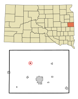
 Location in Brookings County and the state of South Dakota |
|
| Coordinates: 44°26′16″N 96°53′29″W / 44.43778°N 96.89139°WCoordinates: 44°26′16″N 96°53′29″W / 44.43778°N 96.89139°W | |
| Country | United States |
| State | South Dakota |
| County | Brookings |
| Area | |
| • Total | 0.38 sq mi (0.98 km2) |
| • Land | 0.37 sq mi (0.96 km2) |
| • Water | 0.01 sq mi (0.03 km2) |
| Elevation | 1,627 ft (496 m) |
| Population (2010) | |
| • Total | 204 |
| • Estimate (2016) | 206 |
| • Density | 551.4/sq mi (212.9/km2) |
| Time zone | Central (CST) (UTC-6) |
| • Summer (DST) | CDT (UTC-5) |
| ZIP code | 57220 |
| Area code(s) | 605 |
| FIPS code | 46-07740 |
| GNIS feature ID | 1254084 |
Bruce is a city in Brookings County, South Dakota, United States. The population was 204 at the 2010 census.
Bruce was originally called Lie, and under the latter name was founded in 1881. It was renamed in 1883, but the namesake is unclear. Some hold Bruce was named for the son one of the early North Western railroad officials, while others believe it was named for Blanche K. Bruce, an African-American statesman and friend of Roscoe Conkling, U.S. Senator from New York at the time.
Bruce is located at 44°26′16″N 96°53′29″W / 44.43778°N 96.89139°W (44.437896, -96.891374), along the Big Sioux River.
According to the United States Census Bureau, the city has a total area of 0.38 square miles (0.98 km2), of which, 0.37 square miles (0.96 km2) is land and 0.01 square miles (0.03 km2) is water.
Bruce has been assigned the ZIP code 57220 and the FIPS place code 07740.
As of the census of 2010, there were 204 people, 95 households, and 58 families residing in the city. The population density was 551.4 inhabitants per square mile (212.9/km2). There were 111 housing units at an average density of 300.0 per square mile (115.8/km2). The racial makeup of the city was 95.6% White, 1.5% Native American, 0.5% Asian, 0.5% Pacific Islander, and 2.0% from two or more races. Hispanic or Latino of any race were 0.5% of the population.
...
Wikipedia
