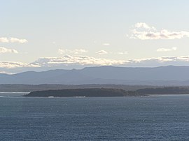
Broulee Island Nature Reserve
|
Broulee Island Nature Reserve New South Wales |
|
|---|---|
|
IUCN category Ia (strict nature reserve)
|
|

Broulee Island looking south from Burri Point
|
|
| Nearest town or city | Broulee |
| Coordinates | 35°51′28″S 150°11′18″E / 35.85778°S 150.18833°ECoordinates: 35°51′28″S 150°11′18″E / 35.85778°S 150.18833°E |
| Established | April 1972 |
| Area | 0.43 km2 (0.2 sq mi) |
| Managing authorities | NSW National Parks & Wildlife Service |
| Website | Broulee Island Nature Reserve |
| See also | Protected areas of New South Wales |
The Broulee Island Nature Reserve is a protected nature reserve located on the south coast of New South Wales, Australia. The 43 ha (110 acres) reserve was created in 1972 and is managed by the NSW National Parks & Wildlife Service. The reserve is situated 23 kilometres (14 mi) south of Batemans Bay and is adjacent to the village of Broulee.
As of July 2008[update] a tombolo connected Broulee Island to the mainland at Broulee Head. Broulee Island Nature Reserve is located entirely in Eurobodalla Shire and within the boundaries of the Mogo Local Aboriginal Land Council.
Broulee aerial photo from east
A directional sign at Broulee Island
...
Wikipedia

