Brooklawn, New Jersey
| Brooklawn, New Jersey | |
|---|---|
| Borough | |
| Borough of Brooklawn | |
 Brooklawn highlighted in Camden County. Inset: Location of Camden County highlighted in the State of New Jersey. |
|
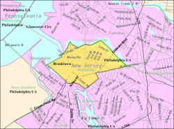
 Census Bureau map of Brooklawn, New Jersey |
|
| Coordinates: 39°52′46″N 75°07′13″W / 39.87935°N 75.120396°WCoordinates: 39°52′46″N 75°07′13″W / 39.87935°N 75.120396°W | |
| Country | |
| State |
|
| County | Camden |
| Incorporated | March 11, 1924 |
| Government | |
| • Type | Borough |
| • Body | Borough Council |
| • Mayor | Theresa "Terri" Branella (D, term ends December 31, 2018) |
| • Clerk | Ryan Giles |
| Area | |
| • Total | 0.525 sq mi (1.359 km2) |
| • Land | 0.492 sq mi (1.274 km2) |
| • Water | 0.033 sq mi (0.085 km2) 6.24% |
| Area rank | 546th of 566 in state 32nd of 37 in county |
| Elevation | 20 ft (6 m) |
| Population (2010 Census) | |
| • Total | 1,955 |
| • Estimate (2015) | 1,933 |
| • Rank | 487th of 566 in state 31st of 37 in county |
| • Density | 3,974.6/sq mi (1,534.6/km2) |
| • Density rank | 154th of 566 in state 19th of 37 in county |
| Time zone | Eastern (EST) (UTC-5) |
| • Summer (DST) | Eastern (EDT) (UTC-4) |
| ZIP code | 08030 |
| Area code(s) | 856 exchanges: 456, 742, 931, 933 |
| FIPS code | 3400708170 |
| GNIS feature ID | 0885172 |
| Website | www |
Brooklawn is a borough in Camden County, New Jersey, United States. As of the 2010 United States Census, the borough's population was 1,955, reflecting a decline of 399 (-16.9%) from the 2,354 counted in the 2000 Census, which had in turn increased by 549 (+30.4%) from the 1,805 counted in the 1990 Census.
Brooklawn was incorporated as a borough on March 11, 1924, from portions of the now-defunct Centre Township, based on the results of a referendum held on April 5, 1924. The borough was reincorporated on March 23, 1926. The borough's name is derived from its location and setting.
According to the United States Census Bureau, Brooklawn borough had a total area of 0.525 square miles (1.359 km2), including 0.492 square miles (1.274 km2) of land and 0.033 square miles (0.085 km2) of water (6.24%).
The borough borders the municipalities of Bellmawr and Gloucester City in Camden County and also borders Gloucester County.
As of the 2010 United States Census, there were 1,955 people, 759 households, and 516.1 families residing in the borough. The population density was 3,974.6 per square mile (1,534.6/km2). There were 806 housing units at an average density of 1,638.6 per square mile (632.7/km2). The racial makeup of the borough was 87.88% (1,718) White, 5.32% (104) Black or African American, 0.10% (2) Native American, 2.20% (43) Asian, 0.00% (0) Pacific Islander, 2.05% (40) from other races, and 2.46% (48) from two or more races. Hispanic or Latino of any race were 6.29% (123) of the population.
...
Wikipedia
