Briton Ferry
Briton Ferry
|
|
|---|---|
 |
|
| Briton Ferry shown within Neath Port Talbot | |
| Population | 5,911 (2 Wards 2011) |
| OS grid reference | SS735945 |
| Principal area | |
| Ceremonial county | |
| Country | Wales |
| Sovereign state | United Kingdom |
| Post town | NEATH |
| Postcode district | SA11 |
| Dialling code | 01639 |
| Police | South Wales |
| Fire | Mid and West Wales |
| Ambulance | Welsh |
| EU Parliament | Wales |
| UK Parliament | |
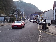
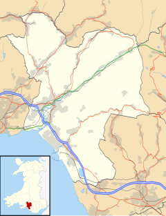
Briton Ferry (Welsh: Llansawel) is a town and community in the county borough of Neath Port Talbot, Wales. The town encompasses the electoral wards of Briton Ferry East and Briton Ferry West.
Briton Ferry is on the mouth of the River Neath where it enters Swansea Bay and was the first river crossing along the Roman road that followed the coastline along that part of South Wales. The river crossing was by ferry boat some 2 miles (3.2 km) from the bridge across the River Neath at Neath. At certain low tides it was possible to walk across the river via a ford close to the ferry route using stepping stones.
The town is served by Briton Ferry railway station.
There are remains of ancient stone age settlements on the hills above Briton Ferry, and two hillforts within the community, Buarth-y-Gaer and Gaer Fawr are on Mynydd-y-Gaer, alongside the boundary with Baglan. The town was part of the Briton Ferry Estate.
The Industrial Revolution brought factories such as the Albion Steel Works, the English Crown Spelter Works and the Baglan Bay Tinplate Works. These were built on land close to the River Neath and the new South Wales Railway, built by Isambard Kingdom Brunel. In 1840 an area of about 750 acres (3.0 km2) of land in Cwmafan was leased for 99 years to John Vigurs and subsequently passed to Wright, Butler & Co. Ltd, then to Baldwins Ltd. The terraces of houses built on this land were sublet in 1897 and 1898 for the remainder of the term of this lease, but many were declared unfit for habitation in the 1930s, and demolished.
...
Wikipedia

