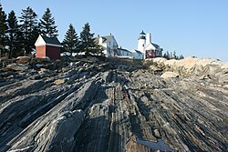
Bristol, Maine
| Bristol, Maine | |
|---|---|
| Town | |

|
|
 Location in Lincoln County and the state of Maine. |
|
| Coordinates: 43°55′29″N 69°29′44″W / 43.92472°N 69.49556°W | |
| Country | United States |
| State | Maine |
| County | Lincoln |
| Incorporated | 1765 |
| Area | |
| • Total | 78.23 sq mi (202.61 km2) |
| • Land | 33.99 sq mi (88.03 km2) |
| • Water | 44.24 sq mi (114.58 km2) |
| Elevation | 121 ft (37 m) |
| Population (2010) | |
| • Total | 2,755 |
| • Estimate (2012) | 2,729 |
| • Density | 81.1/sq mi (31.3/km2) |
| Time zone | Eastern (EST) (UTC-5) |
| • Summer (DST) | EDT (UTC-4) |
| ZIP code | 04539 |
| Area code(s) | 207 |
| FIPS code | 23-07485 |
| GNIS feature ID | 0582369 |
| Website | www.bristolmaine.org |
Bristol (formerly known as Pemaquid) is a town in Lincoln County, Maine, United States. The population was 2,755 at the 2010 census. A fishing and resort area, Bristol includes the villages of New Harbor, Pemaquid, Round Pond, Bristol Mills and Chamberlain. It includes the Pemaquid Archeological Site, a U.S. National Historic Landmark. During the 17th and early 18th century, New France defined the Kennebec River as the southern boundary of Acadia, which put Bristol within Acadia.
Once territory of the Wawenock (or Walinakiak, meaning "People of the Bay") Abenaki Indians, early Bristol was one of the most important and embattled frontier settlements in the province. Beginning with seasonal fishing, as early as 1625 the English established at Pemaquid Point a year-round trading post for fur trading. In 1631, the area was granted as the Pemaquid Patent by the Plymouth Council to Robert Aldsworth and Gyles Elbridge, merchants from Bristol, England.
A village and palisade fort were constructed.
In 1632, Pemaquid was raided and plundered by the pirate Dixie Bull.
...
Wikipedia
