Brewood and Coven
| Brewood | |
|---|---|
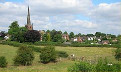
 Brewood from the canal |
|
| Brewood shown within Staffordshire | |
| Population | 7,329 (2011) |
| OS grid reference | SJ883088 |
| District | |
| Shire county | |
| Region | |
| Country | England |
| Sovereign state | United Kingdom |
| Post town | STAFFORD |
| Postcode district | ST19 |
| Dialling code | 01902 |
| Police | Staffordshire |
| Fire | Staffordshire |
| Ambulance | West Midlands |
| EU Parliament | West Midlands |
Brewood ![]() i/ˈbruːd/ refers both to a settlement, which was once a town but is now a village, in South Staffordshire, England, and to the civil parish of which it is the centre. Located around grid reference SJ883088, Brewood village lies near the River Penk, eight miles north of Wolverhampton city centre and eleven miles south of the county town of Stafford. Some three miles to the west of Brewood is the border with the county of Shropshire.
i/ˈbruːd/ refers both to a settlement, which was once a town but is now a village, in South Staffordshire, England, and to the civil parish of which it is the centre. Located around grid reference SJ883088, Brewood village lies near the River Penk, eight miles north of Wolverhampton city centre and eleven miles south of the county town of Stafford. Some three miles to the west of Brewood is the border with the county of Shropshire.
The Norman Domesday Book documented the village as 'Breude'. The name is probably a compound made up of a Celtic, Brythonic word with an Anglo Saxon, Old English word.
The first element is the British word 'briga', which appears in modern Welsh as 'bre'. This is the most common of a number of Celtic place-name elements signifying a hill. It appears in various combinations, but sometimes on its own, as in Bray. Margaret Gelling, a specialist in West Midland toponyms, suggested that it was often misunderstood by the Anglo-Saxons as a name rather than as a common noun. So they thought they had come upon a place called by the natives Brig or Bre, rather than simply a hill. This is why the word is often combined tautologically, as in Breedon on the Hill, where all three elements have the same meaning.
...
Wikipedia

