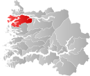
Bremanger Municipality
| Bremanger kommune | |||
|---|---|---|---|
| Municipality | |||
 |
|||
|
|||
 Bremanger within Sogn og Fjordane |
|||
| Coordinates: 61°48′31″N 05°25′15″E / 61.80861°N 5.42083°ECoordinates: 61°48′31″N 05°25′15″E / 61.80861°N 5.42083°E | |||
| Country | Norway | ||
| County | Sogn og Fjordane | ||
| District | Nordfjord | ||
| Administrative centre | Svelgen | ||
| Government | |||
| • Mayor (2011) | Karl Vidar Førde (Sp) | ||
| Area | |||
| • Total | 832.27 km2 (321.34 sq mi) | ||
| • Land | 786.40 km2 (303.63 sq mi) | ||
| • Water | 45.87 km2 (17.71 sq mi) | ||
| Area rank | 132 in Norway | ||
| Population (2013) | |||
| • Total | 3,945 | ||
| • Rank | 236 in Norway | ||
| • Density | 5.0/km2 (13/sq mi) | ||
| • Change (10 years) | -3.2 % | ||
| Demonym(s) | Bremangar | ||
| Time zone | CET (UTC+1) | ||
| • Summer (DST) | CEST (UTC+2) | ||
| ISO 3166 code | NO-1438 | ||
| Official language form | Nynorsk | ||
| Website | www |
||
|
|
|||
Bremanger is a municipality in Sogn og Fjordane county, Norway. The village of Svelgen is the administrative centre of the municipality. Other villages include Bremanger, Berle, Davik, Isane, Kalvåg, Svelgen, Rugsund, and Ålfoten. Bremanger is the only municipality in Sogn og Fjordane, which is located in two districts. The northern and eastern parts comprising the villages of Oldeide, Berle, Rugsund, Davik, Isane, and Ålfoten is located in the Nordfjord region, while the villages of Bremanger, Kalvåg, Svelgen, Sørgulen, and Botnane are located in the Sunnfjord region. Politically, the municipality works with the Nordfjord region in the council of Nordfjord municipalities.
Bremanger has many tourist destinations such as Kalvåg, which has one of the largest and best-kept waterfront environment in the county, the Grotlesanden ocean beach, the Hornelen mountain, with the tallest sea cliff in Northern Europe, Rock carvings at Vingen, and the old trading stations of Rugsund and Smørhavn.
The new Vinge Tunnel was completed in 2013 to more easily connect the outer islands of Bremanger to the municipal centre of Svelgen. The Skatestraum Tunnel and Rugsund Bridge connect the islands to the mainland.
Valleys in the municipality include Førdedalen.
The parish of Kinn was established as a municipality on 1 January 1838 (see formannskapsdistrikt). The northern district of Kinn was established as the parish (prestegjeld) of Bremanger within the municipality of Kinn in 1864. On 1 January 1866, the parish of Bremanger became a separate municipality with a population of 1,852. The Bremanger parish was sub-divided into new sub-parishes in the early 1900s. Midtgulen sub-parish was created in 1903 and Bremangerpollen in 1908. On 1 January 1964, the Husefest and Breivik farms were transferred from Bremanger to the neighboring municipality of Flora.
...
Wikipedia


