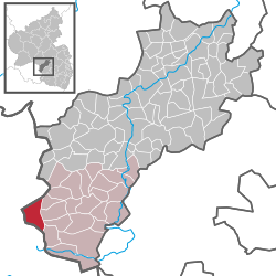
Breitenbach, Rhineland-Palatinate
| Breitenbach | ||
|---|---|---|
|
||
| Coordinates: 49°26′01″N 7°16′11″E / 49.43361°N 7.26972°ECoordinates: 49°26′01″N 7°16′11″E / 49.43361°N 7.26972°E | ||
| Country | Germany | |
| State | Rhineland-Palatinate | |
| District | Kusel | |
| Municipal assoc. | Oberes Glantal | |
| Government | ||
| • Mayor | Jürgen Knapp (SPD) | |
| Area | ||
| • Total | 8.89 km2 (3.43 sq mi) | |
| Elevation | 364 m (1,194 ft) | |
| Population (2015-12-31) | ||
| • Total | 1,826 | |
| • Density | 210/km2 (530/sq mi) | |
| Time zone | CET/CEST (UTC+1/+2) | |
| Postal codes | 66916 | |
| Dialling codes | 06386 | |
| Vehicle registration | KUS | |
| Website | breitenbach-pfalz.de | |
Breitenbach is an Ortsgemeinde – a municipality belonging to a Verbandsgemeinde, a kind of collective municipality – in the Kusel district in Rhineland-Palatinate, Germany. It belongs to the Verbandsgemeinde of Oberes Glantal. Breitenbach is one of the Kusel district’s eight biggest municipalities. It is also the Palatinate’s westernmost municipality.
The municipality lies in the Kusel Musikantenland (“Minstrels’ Land”) in the Western Palatinate, on the state boundary with the Saarland. The village stretches over a high hollow some 380 m above sea level, ringed by elevations some of which reach up to 450 m above sea level and with an opening towards the south leading to the neighbouring village of Lautenbach in the Saarland, through which the land falls off to about 350 m above sea level by the time it reaches the boundary. Flowing in this direction, too, is a brook, itself known by the same name as the municipality, the Breitenbach, but it is also known as the Schönbach. The Breitenbach or Schönbach empties within the village of Lautenbach into another brook, this one with the same name as that village, the Lautenbach, which itself flows into the Osterbach. In the municipality’s northwest lies the Labach mine, which likewise lies on a brook with the same name, the Labach. This flows into the Oster after only about a kilometre, just north of Dörrenbach. The Labach mine was one of three former coalmines within Breitenbach’s municipal limits. Well patronized is the countryside inn that now stands here. Other mines were the Augustusgrube in the north and a gallery in the west on the Dörrenbacher Weg (road). Most of the homesteads named below stretch in an east-west direction north of the village, although the Mühlberghof lies in the southwest and the Bambergerhof and Berghof lie in the southeast. The municipal area measures 889 ha, of which 267 ha is wooded.
...
Wikipedia


