Brea, California
| Brea, California | ||
|---|---|---|
| City | ||

Market City Cafe in Brea downtown
|
||
|
||
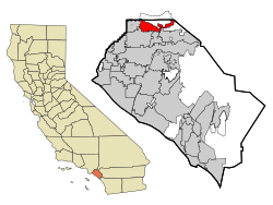
 Location of Brea within Orange County, California |
||
| Location in the United States | ||
| Coordinates: 33°55′24″N 117°53′20″W / 33.92333°N 117.88889°WCoordinates: 33°55′24″N 117°53′20″W / 33.92333°N 117.88889°W | ||
| Country |
|
|
| State |
|
|
| County | Orange | |
| Incorporated | February 23, 1917 | |
| Government | ||
| • City Council | Mayor Marty Simonoff Mayor Pro Team Christine Marick Steven Vargas Glenn Parker Cecilca Hupp |
|
| • City treasurer | William Christensen | |
| • City manager | Tim O'Donnell | |
| Area | ||
| • Total | 12.109 sq mi (31.363 km2) | |
| • Land | 12.078 sq mi (31.283 km2) | |
| • Water | 0.031 sq mi (0.080 km2) 0.26% | |
| Elevation | 361 ft (110 m) | |
| Population (April 1, 2010) | ||
| • Total | 39,282 | |
| • Estimate (2013) | 40,963 | |
| • Density | 3,200/sq mi (1,300/km2) | |
| Time zone | PST (UTC−8) | |
| • Summer (DST) | PDT (UTC−7) | |
| ZIP codes | 92821–92823 | |
| Area codes | 657/714, 562 | |
| FIPS code | 06-08100 | |
| GNIS feature IDs | 1660373, 2409897 | |
| Website | www |
|
Brea (meaning "oil" or "tar" in Spanish) is a city in Orange County, California. The population as of the 2010 census was 39,282. It is located 33 miles southeast of Los Angeles.
The city began as a center of crude oil production, was later propelled by citrus production, and is now an important retail center because of the large Brea Mall and the recently redeveloped Brea Downtown. Brea is also known for its extensive public art program which began in 1975 and continues today with over 140 artworks in the collection placed and located throughout the city. Brea's public art program has been used as a model and inspiration for many public art programs across the United States
The area was visited on July 29, 1769 by the Spanish Portolá expedition - first Europeans to see inland parts of Alta California. The party camped in Brea Canyon, near a large native village and a small pool of clean water. A historical marker dedicated to his visit stands in Brea Canyon just north of town.
The village of Olinda was founded in present-day Carbon Canyon at the beginning of the 19th century and many entrepreneurs came to the area searching for "black gold" (petroleum). In 1894, the owner of the land, Abel Stearns, sold 1,200 acres (4.9 km2) to the west of Olinda to the newly created Union Oil Company of California, and by 1898 many nearby hills began sporting wooden oil-drilling towers on the newly discovered Brea-Olinda Oil Field. In 1908 the village of Randolph, named for railway engineer Epes Randolph, was founded just south of Brea Canyon for the oil workers and their families. Baseball legend Walter Johnson grew up in Olinda at the start of the 20th century where he worked in the surrounding oil fields as a youth.
...
Wikipedia


