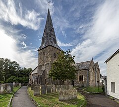
Braunton
| Braunton | |
|---|---|
 St Brannock's Church |
|
 Village Green |
|
| Braunton shown within Devon | |
| Population | 7,353 (2011) |
| OS grid reference | SS485365 |
| Civil parish |
|
| District | |
| Shire county | |
| Region | |
| Country | England |
| Sovereign state | United Kingdom |
| Post town | BRAUNTON |
| Postcode district | EX33 |
| Dialling code | 01271 |
| Police | Devon and Cornwall |
| Fire | Devon and Somerset |
| Ambulance | South Western |
| EU Parliament | South West England |
Braunton is an English village, civil parish, ecclesiastical parish and former manor in North Devon. The village is situated 5 miles (8 km) west of Barnstaple. While not the largest village in England, it is amongst the most populous in Devon with a population at the 2011 census of 7,353 people. There are two electoral wards (East and West). Their joint population at the above census was 8,218. Within the parish is the fertile, low-lying Braunton Great Field, which adjoins the undulating Braunton Burrows, the Core Area in North Devon Biosphere Reserve, the largest psammosere (sand dune system) in England. It confronts the Atlantic Ocean at the west of the parish at the large beach of Saunton Sands, one of the South West's international-standard surfing beaches.
Braunton is derived from the two Old English elements: brōm, meaning broom shrub, and tūn, meaning "farmstead" or "settlement". It thus signifies: "farmstead where broom grows". The name is recorded in the Domesday Book of 1086 as BRANTONE.
The South West Coast Path National Trail passes through the village and gives access for walkers to the spectacular North Devon coast. The Tarka Trail also passes through the village. Braunton Burrows marsh on the west side of the parish is a designated biosphere reserve, the first place in Great Britain to have gained such status. The coastal part of the parish lies within the North Devon Coast Area of Outstanding Natural Beauty, and comprises Saunton Sands to the west, a beach of finely-grained sand, and to the south the estuary of the River Taw, of mixed mud and sand. The north of Braunton Burrows are open to light public access and have been converted into a Links Golf Course. Braunton was half-surrounded by an extensive salt-water marsh restricting available agricultural land. In 1808 this was surveyed by Charles Vancouver, for the Board of Agriculture, who recommended that the marsh should be enclosed and reclaimed. This met with local approval and James Green was appointed as engineer for the drainage scheme. An Act of Parliament was obtained for the purpose on 25 May 1811. On completion, responsibility for the marsh passed Marsh Inspectors, who sanctioned further work in 1854, involving the straightening and embanking of the River Caen, or Braunton Pill, to form the Braunton Canal. The scheme was completed by the addition of a new quay at Velator in the 1870s.
...
Wikipedia

