Brandon, Wisconsin
| Brandon, Wisconsin | |
|---|---|
| Village | |

Looking west in Brandon
|
|
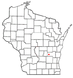
 Location of Brandon, Wisconsin |
|
| Coordinates: 43°44′8″N 88°46′56″W / 43.73556°N 88.78222°WCoordinates: 43°44′8″N 88°46′56″W / 43.73556°N 88.78222°W | |
| Country | United States |
| State | Wisconsin |
| County | Fond du Lac |
| Area | |
| • Total | 0.77 sq mi (1.99 km2) |
| • Land | 0.76 sq mi (1.97 km2) |
| • Water | 0.01 sq mi (0.03 km2) |
| Elevation | 1,001 ft (305 m) |
| Population (2010) | |
| • Total | 879 |
| • Estimate (2012) | 873 |
| • Density | 1,156.6/sq mi (446.6/km2) |
| Time zone | Central (CST) (UTC-6) |
| • Summer (DST) | CDT (UTC-5) |
| Area code(s) | 920 |
| FIPS code | 55-09300 |
| GNIS feature ID | 1562145 |
| Website | villageofbrandon |
Brandon is a village in Fond du Lac County, Wisconsin, United States. The population was 879 at the 2010 census.
Brandon was originally dubbed "Bungtown" in the town's creation in 1856.
The Rens Hemp Company of Brandon, Wisconsin, closed in 1958, the last legal hemp producer nationwide in operation following the World Wars. Prior to its 1957 shutdown, Rens had been the primary provider of hemp rope for the United States Navy.
Brandon is located at 43°44′8″N 88°46′56″W / 43.73556°N 88.78222°W (43.735444, -88.782093).
According to the United States Census Bureau, the village has a total area of 0.77 square miles (1.99 km2), of which, 0.76 square miles (1.97 km2) of it is land and 0.01 square miles (0.03 km2) is water.
As of the census of 2010, there were 879 people, 336 households, and 233 families residing in the village. The population density was 1,156.6 inhabitants per square mile (446.6/km2). There were 369 housing units at an average density of 485.5 per square mile (187.5/km2). The racial makeup of the village was 94.8% White, 0.5% African American, 0.3% Native American, 3.1% from other races, and 1.4% from two or more races. Hispanic or Latino of any race were 5.0% of the population.
...
Wikipedia
