Brandon, South Dakota
| Brandon, South Dakota | |
|---|---|
| City | |

Downtown Brandon looking north on Main Street, March 2015
|
|
| Motto: "Building a Better Life" | |
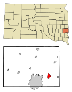
 Location in Minnehaha County and the state of South Dakota |
|
| Location in the United States | |
| Coordinates: 43°35′30″N 96°34′50″W / 43.59167°N 96.58056°WCoordinates: 43°35′30″N 96°34′50″W / 43.59167°N 96.58056°W | |
| Country | United States |
| State | South Dakota |
| County | Minnehaha |
| Incorporated | 1973 |
| Government | |
| • Mayor | Larry Beesley |
| Area | |
| • Total | 5.41 sq mi (14.01 km2) |
| • Land | 5.37 sq mi (13.91 km2) |
| • Water | 0.04 sq mi (0.10 km2) |
| Elevation | 1,355 ft (413 m) |
| Population (2010) | |
| • Total | 8,785 |
| • Estimate (2015) | 9,856 |
| • Density | 1,635.9/sq mi (631.6/km2) |
| Time zone | Central (UTC-6) |
| • Summer (DST) | Central (UTC-5) |
| ZIP code | 57005 |
| Area code(s) | 605 |
| FIPS code | 46-06840 |
| GNIS feature ID | 1254042 |
| Website | City of Brandon |
Brandon is a city in Minnehaha County, South Dakota, United States and is the largest suburb of Sioux Falls. Brandon is located five miles east of Sioux Falls. The population was estimated at 9,856 by the United States Census Bureau in July 1, 2015, which was up from 8,785 at the 2010 census.
A post office called Brandon has been in operation since 1878. The city took its name from Brandon Township.
Brandon is located at 43°35′30″N 96°34′50″W / 43.59167°N 96.58056°W (43.591580, -96.580685), along the Big Sioux River and Split Rock Creek.
According to the United States Census Bureau, the city has a total area of 5.41 square miles (14.01 km2), of which, 5.37 square miles (13.91 km2) is land and 0.04 square miles (0.10 km2) is water.
As of the census of 2010, there were 8,785 people, 3,118 households, and 2,417 families residing in the city. The population density was 1,635.9 inhabitants per square mile (631.6/km2). There were 3,238 housing units at an average density of 603.0 per square mile (232.8/km2). The racial makeup of the city was 96.8% White, 0.6% African American, 0.5% Native American, 0.6% Asian, 0.3% from other races, and 1.2% from two or more races. Hispanic or Latino of any race were 1.2% of the population.
...
Wikipedia

