Bouse
| Bouse, Arizona | |
|---|---|
| CDP | |
![Gold on hematite from the old Dutchman Mine near Bouse [1]](http://upload.wikimedia.org/wikipedia/commons/thumb/c/c1/Gold-Hematite-164016.jpg/250px-Gold-Hematite-164016.jpg)
Gold on hematite from the old Dutchman Mine near Bouse
|
|
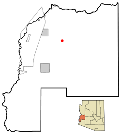
 Location in La Paz County and the state of Arizona |
|
| Location in the United States | |
| Coordinates: 33°56′1″N 114°0′30″W / 33.93361°N 114.00833°WCoordinates: 33°56′1″N 114°0′30″W / 33.93361°N 114.00833°W | |
| Country | United States |
| State | Arizona |
| County | La Paz |
| Area | |
| • Total | 136.22 sq mi (352.82 km2) |
| • Land | 136.22 sq mi (352.82 km2) |
| • Water | 0.00 sq mi (0.00 km2) |
| Elevation | 948 ft (289 m) |
| Population (2000) | |
| • Total | 730 |
| • Estimate (2016) | N/A |
| Time zone | MST (no daylight saving time) (UTC-7) |
| ZIP code | 85325 |
| Area code(s) | 928 |
| FIPS code | 04-07310 |
| GNIS feature ID | 0001887 |
Bouse (pronounced to rhyme with "house") is a census-designated place (CDP) in La Paz County, Arizona, United States. Founded in 1908 as a mining camp, the economy of Bouse is now based on tourism, agriculture and retirees. The population was 996 at the 2010 census.
Bouse is located at 33°56′1″N 114°0′30″W / 33.93361°N 114.00833°W (33.933657, -114.008268).
According to the United States Census Bureau, the CDP has a total area of 10.1 square miles (26 km2), all of it land.
Camp Bouse, 20 mi (32 km) east in Butler Valley, is the former site of a World War II US Army tank training camp. Although the buildings are gone, a few foundations remain, as do some of the tank tracks from World War II. There is a Camp Bouse memorial monument in Bouse.
As of the census of 2010, there were 996 people, 547 households, and 303 families residing in the CDP. The population density was 60.9 people per square mile (23.5/km²). There were 562 housing units at an average density of 55.7 per square mile (21.5/km²). The racial makeup of the CDP was 95.61% White, 0.33% Black or African American, 1.30% Native American, 0.16% Asian, 0.33% Pacific Islander, 0.81% from other races, and 1.46% from two or more races. Hispanic or Latino of any race were 4.55% of the population.
...
Wikipedia

