Bournemouth Airport
| Bournemouth Airport | |||||||||||
|---|---|---|---|---|---|---|---|---|---|---|---|
 |
|||||||||||
 |
|||||||||||
| Summary | |||||||||||
| Airport type | Private | ||||||||||
| Owner/Operator | Manchester Airports Group | ||||||||||
| Serves | South Wiltshire, Dorset, New Forest | ||||||||||
| Location | Hurn, Dorset | ||||||||||
| Elevation AMSL | 38 ft / 12 m | ||||||||||
| Coordinates | 50°46′48″N 001°50′33″W / 50.78000°N 1.84250°WCoordinates: 50°46′48″N 001°50′33″W / 50.78000°N 1.84250°W | ||||||||||
| Website | bournemouthairport.com | ||||||||||
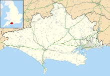
| Map | |||||||||||
| Location in Dorset | |||||||||||
| Runways | |||||||||||
|
|||||||||||
| Statistics (2015 - Provisional) | |||||||||||
|
|||||||||||
| Passengers | 705,443 |
|---|---|
| Passenger change 14-15 |
|
| Aircraft Movements (2014) | 43,122 |
| Movements change 13-14 |
|
Bournemouth Airport (IATA: BOH, ICAO: EGHH) (previously known as Hurn Airport and Bournemouth International Airport) is an airport located 3.5 NM (6.5 km; 4.0 mi) north-northeast of Bournemouth, in southern England. The site opened as RAF Hurn in 1941 and began commercial services in the late 1950s, with Palmair commencing flights to Majorca in October 1958.
Subsequently, Ryanair and Thomson Airways based aircraft at the airport, with scheduled flights now frequently serving Western Europe and the Mediterranean area, with charter and seasonal services serving North Africa, North America, and the Caribbean. Passenger numbers peaked in 2007 when just over one million passed through the airport. In 2014 the passenger total was around 660,000.
Ryanair and Thomson Airways remain the primary users of the airport, which is owned and operated by Manchester Airports Group (MAG), the largest British airport operator.
Bournemouth Airport is situated on the edge of Hurn village in the Borough of Christchurch, 4 miles (6 km) north of Bournemouth, 1 mile (1.6 km) west of the A338 and approximately 100 miles (160 km) south west of London. The airport is accessible via the A31 from the M27 and M3 motorways to the east, and via the A35 to the west. The nearest other airports serving the area are Exeter International Airport, Bristol Airport and Southampton Airport.
...
Wikipedia

