Bourne End, Buckinghamshire
| Bourne End | |
|---|---|
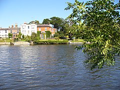
 Older properties by the Thames |
|
 21st century development by the Thames |
|
| Bourne End shown within Buckinghamshire | |
| Population | 5,320 |
| OS grid reference | SU895875 |
| Civil parish | |
| District | |
| Shire county | |
| Region | |
| Country | England |
| Sovereign state | United Kingdom |
| Post town | BOURNE END |
| Postcode district | SL8 |
| Dialling code | 01628 |
| Police | Thames Valley |
| Fire | Buckinghamshire |
| Ambulance | South Central |
| EU Parliament | South East England |
| UK Parliament | |
Bourne End is a village mostly in the parish of Wooburn and Bourne End, but also in the parish of Little Marlow, in Buckinghamshire, England. At the 2011 Census the population was listed in the civil parish of Wooburn. The village is near the border with Berkshire, on the north side of the River Thames, close to where the River Wye empties into the Thames.
Bourne End's original location is somewhat different from today's established village centre, a half a mile downstream on the River Thames. The name refers to the end of the river (bourne being an Old English term for 'river'), and it would be the mouth of the River Wye that this is derived from. The then hamlet appears on Morden's 1722 map of Buckinghamshire as "Born end". It was noted in the nineteenth century however, that the name had been corrupted to "Bone End", apparently through local mispronunciation, and thence on official maps and documents; in 1858, the vicar of Wooburn successfully reversed this, and the corrected name remains in use today.
The entire length of the River Wye was the provider of water power for many mills in the valley for hundreds of years, and Bourne End was no exception. There were four on the final stretch of the river; Princes Mill, Jacksons (or Gunpowder) Mill, Hedsor Mill and Lower Mill. These mills were historically the predominant employers of the area, along with the local farms and two wharfs on the Thames.
In the early nineteenth century, the settlement known as Bourne End was a hamlet of Wooburn parish, along with others such as Spring Gardens, Eghams Green, Cores End, Heavens Lea and Upper Bourne End. This changed with the emergence of the Wycombe Railway Company in 1846. By 1854, Isambard Kingdom Brunel had designed and constructed a railway linking Maidenhead to High Wycombe. The station was originally known as Marlow Road station, until 1874, a year after the branch line to Marlow was built, and from then on Bourne End station. The railway created more travel opportunities for locals and greatly benefited the mills, and thus Bourne End expanded, on a greater scale than other similar settlements in the surrounding area. See Marlow Branch Line and Marlow Donkey for more information.
...
Wikipedia

