Boone County Airport (Arkansas)
|
Boone County Airport Boone County Regional Airport |
|||||||||||
|---|---|---|---|---|---|---|---|---|---|---|---|

Aerial view of airport, 2009
|
|||||||||||
| Summary | |||||||||||
| Airport type | Public | ||||||||||
| Owner | Boone County | ||||||||||
| Serves | Harrison, Arkansas | ||||||||||
| Elevation AMSL | 1,365 ft / 416 m | ||||||||||
| Coordinates | 36°15′41″N 093°09′17″W / 36.26139°N 93.15472°WCoordinates: 36°15′41″N 093°09′17″W / 36.26139°N 93.15472°W | ||||||||||
| Website | BooneCountyAirport.com | ||||||||||
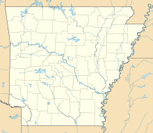
| Map | |||||||||||
| Location of airport in Arkansas / United States | |||||||||||
| Runways | |||||||||||
|
|||||||||||
| Statistics (2010) | |||||||||||
|
|||||||||||
|
Source: FAA and airport web site
|
|||||||||||
| Aircraft operations | 8,500 |
|---|---|
| Based aircraft | 48 |
Boone County Airport (IATA: HRO, ICAO: KHRO, FAA LID: HRO) is a county-owned public-use airport in Boone County, Arkansas, United States. Also known as Boone County Regional Airport, it is located three nautical miles (6 km) northwest of the central business district of Harrison, Arkansas. The airport serves the surrounding areas including Branson, Missouri. It is mostly used for general aviation but is also served by one commercial airline, a service which is subsidized by the federal government's Essential Air Service program at a cost of $2,251,207(per year). As per Federal Aviation Administration records, the airport had 1,903 passenger boardings (enplanements) in calendar year 2008, 276 enplanements in 2009, and 1,778 in 2010. This airport is included in the National Plan of Integrated Airport Systems for 2011–2015, which categorized it as a general aviation airport (the commercial service category requires at least 2,500 enplanements per year).
Boone County Airport covers an area of 425 acres (172 ha) at an elevation of 1,365 feet (416 m) above mean sea level. It has one runway designated 18/36 with an asphalt surface measuring 6,161 by 150 feet (1,878 x 46 m).
...
Wikipedia


