Bois-le-Duc
|
's-Hertogenbosch Den Bosch |
||||||||||||||
|---|---|---|---|---|---|---|---|---|---|---|---|---|---|---|
| City and Municipality | ||||||||||||||
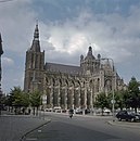
From top down, left to right: View over the city centre
The city seen from the , Binnendieze canals, of Brabant, , , , Hieronymus Bosch, , St. John's Cathedral, , Street view Paleiskwartier, |
||||||||||||||
|
||||||||||||||
 Location in North Brabant |
||||||||||||||
| Coordinates: 51°41′N 5°18′E / 51.683°N 5.300°ECoordinates: 51°41′N 5°18′E / 51.683°N 5.300°E | ||||||||||||||
| Country | Netherlands | |||||||||||||
| Province | North Brabant | |||||||||||||
| Government | ||||||||||||||
| • Body | Municipal council | |||||||||||||
| • Mayor | Ton Rombouts (CDA) | |||||||||||||
| Area | ||||||||||||||
| • Municipality | 91.79 km2 (35.44 sq mi) | |||||||||||||
| • Land | 84.45 km2 (32.61 sq mi) | |||||||||||||
| • Water | 7.34 km2 (2.83 sq mi) | |||||||||||||
| Elevation | 6 m (20 ft) | |||||||||||||
| Population (Municipality, August 2017; Urban and Metro, May 2014) | ||||||||||||||
| • Municipality | 152,968 | |||||||||||||
| • Density | 1,811/km2 (4,690/sq mi) | |||||||||||||
| • Urban | 169,714 | |||||||||||||
| • Metro | 198,000 | |||||||||||||
| • Metro region | 355,230 | |||||||||||||
| • Brabant CMSA | 1,932,055 | |||||||||||||
| Demonym(s) | Bosschenaar | |||||||||||||
| Time zone | CET (UTC+1) | |||||||||||||
| • Summer (DST) | CEST (UTC+2) | |||||||||||||
| Postcode | 5200–5249 | |||||||||||||
| Area code | 073 | |||||||||||||
| Website | s-hertogenbosch |
|||||||||||||
's-Hertogenbosch (Dutch pronunciation: [ˌsɛrtoːɣə(n)ˈbɔs] (![]() listen), literally "The Duke's Forest" in English, and historically in French: Bois-le-Duc), colloquially known as Den Bosch (pronounced [dɛn ˈbɔs] (
listen), literally "The Duke's Forest" in English, and historically in French: Bois-le-Duc), colloquially known as Den Bosch (pronounced [dɛn ˈbɔs] (![]() listen), literally "The Forest" in English), is a city and municipality in the southern Netherlands. It is the capital of the province of North Brabant.
listen), literally "The Forest" in English), is a city and municipality in the southern Netherlands. It is the capital of the province of North Brabant.
The city's official name is a contraction of the Dutch des Hertogen bosch—"the Duke's forest". The duke in question was Duke Henry I of Brabant, whose family had owned a large estate at nearby Orthen for at least four centuries. He founded a new town located on some forested dunes in the middle of a marsh. At age 26, he granted 's-Hertogenbosch city rights and the corresponding trade privileges in 1185. This is, however, the traditional date given by later chroniclers; the first mention in contemporaneous sources is 1196. The original charter has been lost. His reason for founding the city was to protect his own interests against encroachment from Gelre and Holland; from its first days, he conceived of the city as a fortress. It was destroyed in 1203 in a joint expedition of Gelre and Holland, but was soon rebuilt. Some remnants of the original city walls may still be seen. In the late 14th century, a much larger wall was erected to protect the greatly expanded settled area. Artificial waterways were dug to serve as a city moat, through which the rivers Dommel and Aa were diverted.
...
Wikipedia


