Bogue Field
| MCALF Bogue | |||||||||||
|---|---|---|---|---|---|---|---|---|---|---|---|

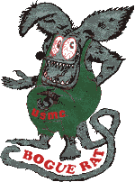
unofficial Bogue Field logo
|
|||||||||||
| Summary | |||||||||||
| Airport type | Military | ||||||||||
| Owner | United States Department of the Navy | ||||||||||
| Operator | United States Marine Corps | ||||||||||
| Location | Bogue Sound / Emerald Isle, North Carolina | ||||||||||
| Built | 1942 | ||||||||||
| In use | 1942-Present (Intermittently) | ||||||||||
| Occupants | 2nd Marine Aircraft Wing/MWSS-271 | ||||||||||
| Elevation AMSL | 21 ft / 6 m | ||||||||||
| Runways | |||||||||||
|
|||||||||||
|
Source: Federal Aviation Administration
|
|||||||||||
Coordinates: 34°41′26″N 077°01′47″W / 34.69056°N 77.02972°W
Marine Corps Auxiliary Landing Field Bogue (ICAO: KNJM, FAA LID: NJM), also known as Bogue Field, is an 875-acre (3.54 km2) landing field located on Bogue Sound (North Carolina) that serves as the Marine Corps’ only East Coast site for Field Carrier Landing Practice (FCLP). By performing many of these landings at night, pilots simulate landing on an aircraft carrier or an amphibious assault ship, which provides the force with the means to forward deploy its aviation assets in order to have a more readily accessible aviation punch for the Marine Air Ground Task Force (MAGTF) commander on the battlefield.
Marines who are assigned to the remote airfield have been nicknamed "Bogue Rats". This nickname is reflected in their unofficial logo.
When the United States Navy purchased 573 acres (2.32 km2) of land in 1942 for an auxiliary airfield, three 4,000-foot (1,200 m) runways were built for the use of Marine Corps Air Station (MCAS) Cherry Point, North Carolina. Facilities were also constructed to support two squadrons with a combined total of 45 aircraft and accommodations for 1,050 personnel.
...
Wikipedia
