Boeotian League
|
Boeotia Περιφερειακή ενότητα Βοιωτίας |
|
|---|---|
| Regional unit | |

Municipalities of Boeotia
|
|
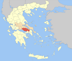
 Boeotia within Greece |
|
| Coordinates: 38°25′N 23°05′E / 38.417°N 23.083°ECoordinates: 38°25′N 23°05′E / 38.417°N 23.083°E | |
| Country | Greece |
| Region | Central Greece |
| Capital | Livadeia |
| Area | |
| • Total | 3,211 km2 (1,240 sq mi) |
| Population (2011) | |
| • Total | 117,920 |
| • Density | 37/km2 (95/sq mi) |
| Postal codes | 32x xx, 190 12 |
| Area codes | 226x0 |
| ISO 3166 code | GR-03 |
| Car plates | ΒΙ |
| Website | www |
Boeotia, sometimes alternatively Latinised as Beotia (/biːˈoʊʃiə/ or /biːˈoʊʃə/; Greek: Βοιωτία, Modern Greek: [vi.oˈti.a], Ancient Greek: [bojɔːtía]; modern transliteration Voiotía, also Viotía, formerly Cadmeis), is one of the regional units of Greece. It is part of the region of Central Greece. It was also a region of ancient Greece. Its capital is Livadeia, and its largest city is Thebes.
Boeotia lies to the north of the eastern part of the Gulf of Corinth. It also has a short coastline on the Gulf of Euboea. It bordered on Megaris (now West Attica) in the south, Attica in the southeast, Euboea in the northeast, Opuntian Locris (now part of Phthiotis) in the north and Phocis in the west.
...
Wikipedia
