Bloomsdale, Missouri
| Bloomsdale, Missouri | |
|---|---|
| City | |

View of Bloomsdale from roadside park on Highway 61
|
|
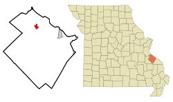
 Location of Bloomsdale, Missouri |
|
| Coordinates: 38°0′57″N 90°13′42″W / 38.01583°N 90.22833°WCoordinates: 38°0′57″N 90°13′42″W / 38.01583°N 90.22833°W | |
| Country | United States |
| State | Missouri |
| County | Ste. Genevieve |
| Township | Jackson Township, Sainte Genevieve County, Missouri |
| Area | |
| • Total | 1.64 sq mi (4.25 km2) |
| • Land | 1.63 sq mi (4.22 km2) |
| • Water | 0.01 sq mi (0.03 km2) |
| Elevation | 509 ft (155 m) |
| Population (2010) | |
| • Total | 521 |
| • Estimate (2016) | 542 |
| • Density | 320/sq mi (120/km2) |
| Time zone | Central (CST) (UTC-6) |
| • Summer (DST) | CDT (UTC-5) |
| FIPS code | 29-06454 |
| GNIS feature ID | 0736278 |
Bloomsdale is a city in Ste. Genevieve County, Missouri, United States. The population was 521 at the 2010 census.
The name of the town most likely derives from the name of a Catholic priest, Father Blume.
Bloomsdale was known as early as 1839 as "La Fourche à Duclos", meaning "the fork of Duclos" and named for the creek by the same name. Its parish priest, a Father Blume, wished his parishioners to all reside on one side of the stream, and so bought land for a settlement on what is now called Establishment Creek moved to the present site of Bloomsdale. One account has it that "Blumesdale" was mailed to Washington, DC, as the name of the town's post office. But the name was illegible, so the story goes, so Washington called the office Bloomsdale. More likely, Washington anglicized the German name Blume ("flower") to Bloom. Either way, the name honors Father Blume.
Bloomsdale is located at 38°0′57″N 90°13′42″W / 38.01583°N 90.22833°W (38.015705, -90.228303), in the eastern part of Jackson Township, near Establishment Creek.
According to the United States Census Bureau, the city has a total area of 1.64 square miles (4.25 km2), of which, 1.63 square miles (4.22 km2) is land and 0.01 square miles (0.03 km2) is water.
As of the census of 2010, there were 521 people, 202 households, and 136 families residing in the city. The population density was 319.6 inhabitants per square mile (123.4/km2). There were 216 housing units at an average density of 132.5 per square mile (51.2/km2). The racial makeup of the city was 98.66% White, 0.58% Black or African American, 0.19% Native American, and 0.58% from two or more races.
...
Wikipedia
