Blendon Township, Ottawa County, Michigan
| Blendon Township, Michigan | |
|---|---|
| Township | |

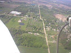
Borculo, a community in the township
|
|
| Location within the state of Michigan | |
| Coordinates: 42°54′13″N 85°57′5″W / 42.90361°N 85.95139°WCoordinates: 42°54′13″N 85°57′5″W / 42.90361°N 85.95139°W | |
| Country | United States |
| State | Michigan |
| County | Ottawa |
| Area | |
| • Total | 36.5 sq mi (94.6 km2) |
| • Land | 36.5 sq mi (94.6 km2) |
| • Water | 0.0 sq mi (0.0 km2) |
| Elevation | 643 ft (196 m) |
| Population (2010) | |
| • Total | 5,772 |
| • Density | 158.1/sq mi (61.0/km2) |
| Time zone | Eastern (EST) (UTC-5) |
| • Summer (DST) | EDT (UTC-4) |
| FIPS code | 26-08940 |
| GNIS feature ID | 1625946 |
| Website | www |
Blendon Township is a civil township of Ottawa County in the U.S. state of Michigan. As of the 2000 census, the township population was 5,721.
There are no incorporated municipalities within the township. There are settlements in the unincorporated communities of Blendon, North Blendon, Borculo (which lies on the western boundary with Olive Township) and Bauer (which lies on the eastern boundary with Georgetown Township).
Olive Township is to the west, Robinson Township to the northwest, Allendale Charter Township to the north, Georgetown Township to the east, Jamestown Charter Township to the southeast, Zeeland Charter Township to the south, and Holland Charter Township to the southwest.
No major roads pass through the township, although Interstate 196 passes just south of the township. The city of Hudsonville is just southeast of the township, while the cities of Zeeland and Holland are just a short distance to the southwest. Grand Rapids is about 15 miles to the east and Grand Haven is 20 miles to the northwest.
Blendon Township was formed in 1854. It was named for the Blendon Lumber Company, which owned much of the land in the township at the time.
According to the United States Census Bureau, the township has a total area of 36.5 square miles (95 km2), all land.
...
Wikipedia

