Bishops Sutton
| Bishops Sutton | |
|---|---|
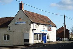
 Bishops Sutton main street with public house |
|
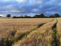
 Barley fields in Bishops Sutton |
|
| Bishops Sutton shown within Hampshire | |
| Population | 419 463 (2011 Census) |
| OS grid reference | SU6066331907 |
| • London | 52.7 miles (84.8 km) |
| District | |
| Shire county | |
| Region | |
| Country | England |
| Sovereign state | United Kingdom |
| Post town | Alresford |
| Postcode district | SO24 |
| Dialling code | 01962 |
| Police | Hampshire |
| Fire | Hampshire |
| Ambulance | South Central |
| EU Parliament | South East England |
| UK Parliament | |
Bishops Sutton or Bishop's Sutton is a village and civil parish 1 mile (1.6 km) east of the market town of Alresford in the City of Winchester district of Hampshire, England. According to the 2001 census it had a population of 419, increasing to 463 at the 2011 Census.
The parish of Bishops Sutton, containing 3,739 acres (15.13 km2) of land and 9 acres (36,000 m2) of land covered with water, is of an irregular shape, the central part, in which the village stands, being in the comparatively low ground (250 ft. above sea level) by the head-waters of the River Alre, while a long strip runs north-east between the parishes of Bighton and Ropley, rising to a height of 500 ft (150 m) along the downs to the north. South of the river the boundary extends to the high ground above Cheriton Wood and Bramdean Common. Watercress cultivation and as at present crop agriculture with pasture formed a major occupation, the soil being quite chalky but southern areas being arable. The advent of the Mid Hants Railway also known as the Watercress Line meant fresh watercress from beds by the calciferous, high, clear River Alre could be delivered to the metropolis of London and elsewhere. Bypassed by an addition to the A31, the historic road bears medium to low traffic into Alresford and two side roads, Church Lane and School Lane with that road form the main developed area.
At the time of the Domesday Survey the place was recorded as Sudtone i.e. Bishop's Sutton (which included Ropley), and Bramdean). The hundred of Bishop's Sutton was known as the hundred of 'Esselei', and comprised those places as well as West Tisted. The villages is by or on (depending on which track was preferred) the Pilgrims' Way between Winchester and Canterbury, which can still be walked via the North Downs Way.
...
Wikipedia

