Bishopbriggs
Bishopbriggs
|
|
|---|---|
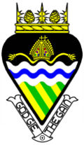
 Bishopbriggs' Burgh Coat of Arms as issued by the Lord Lyon King of Arms |
|
| Bishopbriggs shown within East Dunbartonshire | |
| Population | 23,500 |
| OS grid reference | NS615705 |
| Council area | |
| Lieutenancy area | |
| Country | Scotland |
| Sovereign state | United Kingdom |
| Post town | GLASGOW |
| Postcode district | G64 |
| Dialling code | 0141 |
| Police | Scottish |
| Fire | Scottish |
| Ambulance | Scottish |
| EU Parliament | Scotland |
| UK Parliament | |
| Scottish Parliament | |
Bishopbriggs is a town in East Dunbartonshire, Scotland. It lies on the northern fringe of Greater Glasgow, approximately 4 miles (6 km) from the City Centre. Historically in Lanarkshire, the area was once part of the historic parish of Cadder - originally lands granted by King William the Lion to the Bishop of Glasgow, Jocelin, in 1180. It was later part of the county of Lanarkshire, and then an independent burgh from 1964 to 1975. Today, Bishopbriggs' close geographic proximity to Glasgow now effectively makes it a suburb and commuter town of the city. The town's Gaelic name Coille Dobhair reflects the name of the old parish of Cadder. It was ranked 2nd in the most desirable postcodes in Scotland to live in following a study by the Centre for Economic and Business Research in 2015.
Bishopbriggs grew from a small rural village on the old road from Glasgow to Kirkintilloch and Stirling during the 19th century, eventually growing to incorporate the adjacent villages of Auchinairn, Cadder, Jellyhill and Mavis Valley. It has a population of approximately 23,500 people.
In July 2016, Google Maps' entry for Bishopbriggs was hacked, causing the main picture for it to appear as a resort in Mauritius.
As early as 1568, reference is made to a path northwards from Glasgow as the 'common passage to Bischopis Briggis'. Bishopbriggs was first documented in the Cadder Parish records of 1655, and was recorded to have had only eleven residents in the mid-18th century. Even more than a century later, after substantial growth, the village was still being referred to in the terms of the larger settlement of Cadder. Despite fears that the village would end up being swamped by the rapid expansion of nearby Glasgow it managed to avoid this, however 2,000 acres (810 ha) of the wider parish of Cadder were eventually absorbed by Glasgow Corporation in 1926, which would be used to construct the Milton peripheral housing scheme from the late 1940s.
...
Wikipedia

